You are here: Home > Network List > UW - Pacific Northwest Regional Seismic Network Stations List
> Station FISH Seaside, OR, USA > Earthquake Result Viewer
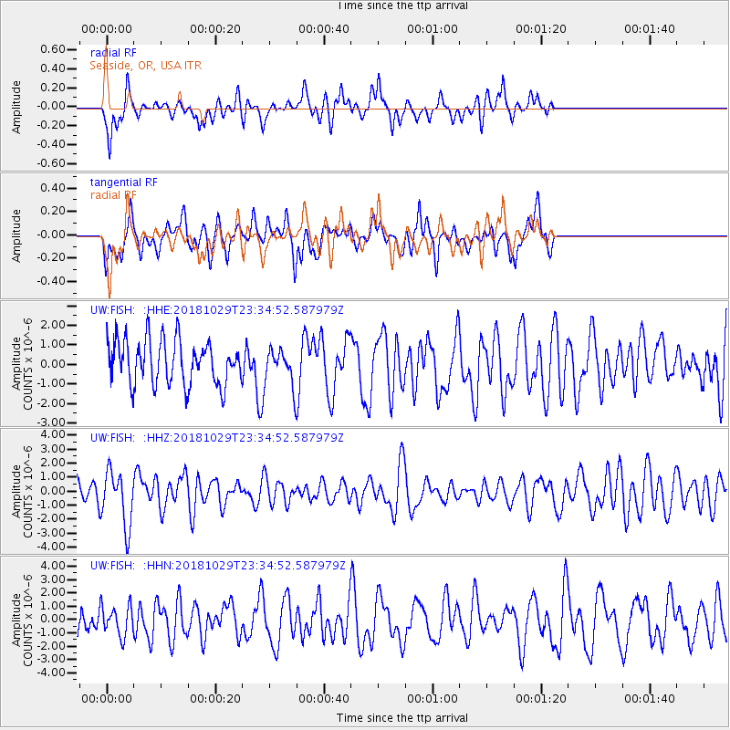
FISH Seaside, OR, USA - Earthquake Result Viewer
*The percent match for this event was below the threshold and hence no stack was calculated.
| Earthquake location: |
Central East Pacific Rise |
| Earthquake latitude/longitude: |
-4.6/-105.9 |
| Earthquake time(UTC): |
2018/10/29 (302) 23:26:09 GMT |
| Earthquake Depth: |
10 km |
| Earthquake Magnitude: |
5.8 Mww |
| Earthquake Catalog/Contributor: |
NEIC PDE/us |
|
| Network: |
UW Pacific Northwest Regional Seismic Network |
| Station: |
FISH Seaside, OR, USA |
| Lat/Lon: |
45.93 N/123.56 W |
| Elevation: |
325 m |
|
| Distance: |
52.7 deg |
| Az: |
344.568 deg |
| Baz: |
157.663 deg |
| Ray Param: |
$rayparam |
*The percent match for this event was below the threshold and hence was not used in the summary stack. |
|
| Radial Match: |
66.959274 % |
| Radial Bump: |
400 |
| Transverse Match: |
53.627247 % |
| Transverse Bump: |
400 |
| SOD ConfigId: |
13570011 |
| Insert Time: |
2019-05-01 16:35:09.566 +0000 |
| GWidth: |
2.5 |
| Max Bumps: |
400 |
| Tol: |
0.001 |
|
Signal To Noise
| Channel | StoN | STA | LTA |
| UW:FISH: :HHZ:20181029T23:34:52.587979Z | 2.0795913 | 1.9649376E-6 | 9.4486717E-7 |
| UW:FISH: :HHN:20181029T23:34:52.587979Z | 0.6315625 | 1.1031925E-6 | 1.7467671E-6 |
| UW:FISH: :HHE:20181029T23:34:52.587979Z | 0.80765927 | 9.044259E-7 | 1.1198113E-6 |
| Arrivals |
| Ps | |
| PpPs | |
| PsPs/PpSs | |


