You are here: Home > Network List > GS - US Geological Survey Networks Stations List
> Station KAN10 Keim Farm > Earthquake Result Viewer
KAN10 Keim Farm - Earthquake Result Viewer
*The percent match for this event was below the threshold and hence no stack was calculated.
| Earthquake location: |
Sakhalin, Russia |
| Earthquake latitude/longitude: |
50.4/142.3 |
| Earthquake time(UTC): |
2016/08/14 (227) 11:15:14 GMT |
| Earthquake Depth: |
5.8 km |
| Earthquake Magnitude: |
5.7 MWW, 5.7 MWB, 5.8 MWC |
| Earthquake Catalog/Contributor: |
NEIC PDE/NEIC COMCAT |
|
| Network: |
GS US Geological Survey Networks |
| Station: |
KAN10 Keim Farm |
| Lat/Lon: |
37.12 N/98.10 W |
| Elevation: |
417 m |
|
| Distance: |
77.9 deg |
| Az: |
45.294 deg |
| Baz: |
325.339 deg |
| Ray Param: |
$rayparam |
*The percent match for this event was below the threshold and hence was not used in the summary stack. |
|
| Radial Match: |
51.861107 % |
| Radial Bump: |
400 |
| Transverse Match: |
52.669037 % |
| Transverse Bump: |
400 |
| SOD ConfigId: |
1634031 |
| Insert Time: |
2016-08-28 11:17:09.271 +0000 |
| GWidth: |
2.5 |
| Max Bumps: |
400 |
| Tol: |
0.001 |
|
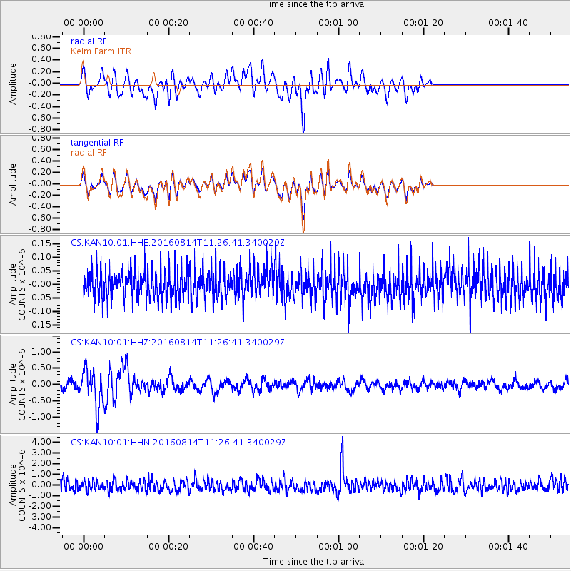
Signal To Noise
| Channel | StoN | STA | LTA |
| GS:KAN10:01:HHZ:20160814T11:26:41.340029Z | 5.2094903 | 5.647158E-7 | 1.0840135E-7 |
| GS:KAN10:01:HHN:20160814T11:26:41.340029Z | 0.8352686 | 3.9008066E-7 | 4.6701223E-7 |
| GS:KAN10:01:HHE:20160814T11:26:41.340029Z | 0.8615779 | 4.2200206E-8 | 4.8980137E-8 |
| Arrivals |
| Ps | |
| PpPs | |
| PsPs/PpSs | |


