You are here: Home > Network List > TS - TERRAscope (Southern California Seismic Network) Stations List
> Station BAR Barrett Dam, California, USA > Earthquake Result Viewer
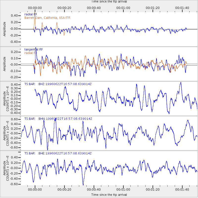
BAR Barrett Dam, California, USA - Earthquake Result Viewer
*The percent match for this event was below the threshold and hence no stack was calculated.
| Earthquake location: |
Laptev Sea |
| Earthquake latitude/longitude: |
75.8/134.6 |
| Earthquake time(UTC): |
1996/06/22 (174) 16:47:12 GMT |
| Earthquake Depth: |
10 km |
| Earthquake Magnitude: |
5.6 MB, 5.5 MS, 5.8 UNKNOWN, 5.7 MW |
| Earthquake Catalog/Contributor: |
WHDF/NEIC |
|
| Network: |
TS TERRAscope (Southern California Seismic Network) |
| Station: |
BAR Barrett Dam, California, USA |
| Lat/Lon: |
32.68 N/116.67 W |
| Elevation: |
548 m |
|
| Distance: |
63.0 deg |
| Az: |
63.708 deg |
| Baz: |
344.807 deg |
| Ray Param: |
$rayparam |
*The percent match for this event was below the threshold and hence was not used in the summary stack. |
|
| Radial Match: |
41.441105 % |
| Radial Bump: |
400 |
| Transverse Match: |
65.32321 % |
| Transverse Bump: |
400 |
| SOD ConfigId: |
4480 |
| Insert Time: |
2010-02-26 13:59:46.508 +0000 |
| GWidth: |
2.5 |
| Max Bumps: |
400 |
| Tol: |
0.001 |
|
Signal To Noise
| Channel | StoN | STA | LTA |
| TS:BAR: :BHN:19960622T16:57:08.639014Z | 1.3486984 | 2.3588322E-7 | 1.7489694E-7 |
| TS:BAR: :BHE:19960622T16:57:08.639014Z | 2.2095425 | 2.6134333E-7 | 1.1827939E-7 |
| TS:BAR: :BHZ:19960622T16:57:08.639014Z | 0.83989745 | 1.2080015E-7 | 1.4382728E-7 |
| Arrivals |
| Ps | |
| PpPs | |
| PsPs/PpSs | |


