You are here: Home > Network List > TA - USArray Transportable Network (new EarthScope stations) Stations List
> Station G23K Bananza Creek, AK, USA > Earthquake Result Viewer
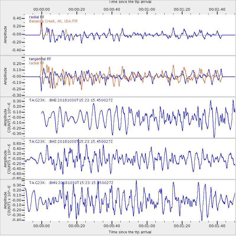
G23K Bananza Creek, AK, USA - Earthquake Result Viewer
*The percent match for this event was below the threshold and hence no stack was calculated.
| Earthquake location: |
Ionian Sea |
| Earthquake latitude/longitude: |
37.5/20.5 |
| Earthquake time(UTC): |
2018/10/30 (303) 15:12:00 GMT |
| Earthquake Depth: |
11 km |
| Earthquake Magnitude: |
5.7 Mww |
| Earthquake Catalog/Contributor: |
NEIC PDE/us |
|
| Network: |
TA USArray Transportable Network (new EarthScope stations) |
| Station: |
G23K Bananza Creek, AK, USA |
| Lat/Lon: |
66.71 N/150.02 W |
| Elevation: |
746 m |
|
| Distance: |
75.8 deg |
| Az: |
356.132 deg |
| Baz: |
7.753 deg |
| Ray Param: |
$rayparam |
*The percent match for this event was below the threshold and hence was not used in the summary stack. |
|
| Radial Match: |
62.269535 % |
| Radial Bump: |
355 |
| Transverse Match: |
56.41854 % |
| Transverse Bump: |
381 |
| SOD ConfigId: |
13570011 |
| Insert Time: |
2019-05-01 16:54:59.359 +0000 |
| GWidth: |
2.5 |
| Max Bumps: |
400 |
| Tol: |
0.001 |
|
Signal To Noise
| Channel | StoN | STA | LTA |
| TA:G23K: :BHZ:20181030T15:23:15.450027Z | 2.541504 | 2.3235688E-7 | 9.142496E-8 |
| TA:G23K: :BHN:20181030T15:23:15.450027Z | 0.5852374 | 7.0178594E-8 | 1.1991474E-7 |
| TA:G23K: :BHE:20181030T15:23:15.450027Z | 1.4983771 | 1.520271E-7 | 1.0146117E-7 |
| Arrivals |
| Ps | |
| PpPs | |
| PsPs/PpSs | |


