You are here: Home > Network List > TA - USArray Transportable Network (new EarthScope stations) Stations List
> Station Y20A Horse Springs, Datil, NM, USA > Earthquake Result Viewer
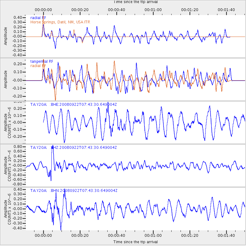
Y20A Horse Springs, Datil, NM, USA - Earthquake Result Viewer
*The percent match for this event was below the threshold and hence no stack was calculated.
| Earthquake location: |
Hokkaido, Japan Region |
| Earthquake latitude/longitude: |
41.6/140.4 |
| Earthquake time(UTC): |
2008/09/22 (266) 07:31:59 GMT |
| Earthquake Depth: |
149 km |
| Earthquake Magnitude: |
5.7 MW, 5.3 MB, 5.6 MW |
| Earthquake Catalog/Contributor: |
WHDF/NEIC |
|
| Network: |
TA USArray Transportable Network (new EarthScope stations) |
| Station: |
Y20A Horse Springs, Datil, NM, USA |
| Lat/Lon: |
33.91 N/108.38 W |
| Elevation: |
2177 m |
|
| Distance: |
81.9 deg |
| Az: |
51.575 deg |
| Baz: |
315.029 deg |
| Ray Param: |
$rayparam |
*The percent match for this event was below the threshold and hence was not used in the summary stack. |
|
| Radial Match: |
45.581276 % |
| Radial Bump: |
293 |
| Transverse Match: |
50.58944 % |
| Transverse Bump: |
351 |
| SOD ConfigId: |
2560 |
| Insert Time: |
2010-03-06 17:23:17.453 +0000 |
| GWidth: |
2.5 |
| Max Bumps: |
400 |
| Tol: |
0.001 |
|
Signal To Noise
| Channel | StoN | STA | LTA |
| TA:Y20A: :BHZ:20080922T07:43:30.649004Z | 5.0906835 | 3.1491174E-7 | 6.1860405E-8 |
| TA:Y20A: :BHN:20080922T07:43:30.649004Z | 1.3680328 | 9.2286434E-8 | 6.7459226E-8 |
| TA:Y20A: :BHE:20080922T07:43:30.649004Z | 1.4481457 | 1.5654796E-7 | 1.0810235E-7 |
| Arrivals |
| Ps | |
| PpPs | |
| PsPs/PpSs | |


