You are here: Home > Network List > TS - TERRAscope (Southern California Seismic Network) Stations List
> Station BAR Barrett Dam, California, USA > Earthquake Result Viewer
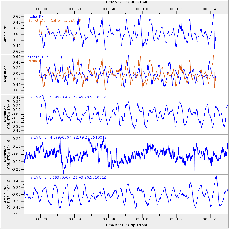
BAR Barrett Dam, California, USA - Earthquake Result Viewer
*The percent match for this event was below the threshold and hence no stack was calculated.
| Earthquake location: |
Tonga Islands |
| Earthquake latitude/longitude: |
-15.4/-173.4 |
| Earthquake time(UTC): |
1995/05/07 (127) 22:38:29 GMT |
| Earthquake Depth: |
33 km |
| Earthquake Magnitude: |
5.7 MS, 5.3 MB, 6.0 UNKNOWN, 5.9 MW |
| Earthquake Catalog/Contributor: |
WHDF/NEIC |
|
| Network: |
TS TERRAscope (Southern California Seismic Network) |
| Station: |
BAR Barrett Dam, California, USA |
| Lat/Lon: |
32.68 N/116.67 W |
| Elevation: |
548 m |
|
| Distance: |
72.3 deg |
| Az: |
47.771 deg |
| Baz: |
237.883 deg |
| Ray Param: |
$rayparam |
*The percent match for this event was below the threshold and hence was not used in the summary stack. |
|
| Radial Match: |
44.158417 % |
| Radial Bump: |
400 |
| Transverse Match: |
45.982296 % |
| Transverse Bump: |
400 |
| SOD ConfigId: |
4480 |
| Insert Time: |
2010-02-26 13:59:49.320 +0000 |
| GWidth: |
2.5 |
| Max Bumps: |
400 |
| Tol: |
0.001 |
|
Signal To Noise
| Channel | StoN | STA | LTA |
| TS:BAR: :BHN:19950507T22:49:20.551001Z | 1.656625 | 8.340303E-8 | 5.0345147E-8 |
| TS:BAR: :BHE:19950507T22:49:20.551001Z | 1.5585717 | 1.5685767E-7 | 1.0064193E-7 |
| TS:BAR: :BHZ:19950507T22:49:20.551001Z | 0.7212958 | 1.1105575E-7 | 1.5396701E-7 |
| Arrivals |
| Ps | |
| PpPs | |
| PsPs/PpSs | |


