You are here: Home > Network List > TA - USArray Transportable Network (new EarthScope stations) Stations List
> Station 121A Cookes Peak, Deming, NM, USA > Earthquake Result Viewer
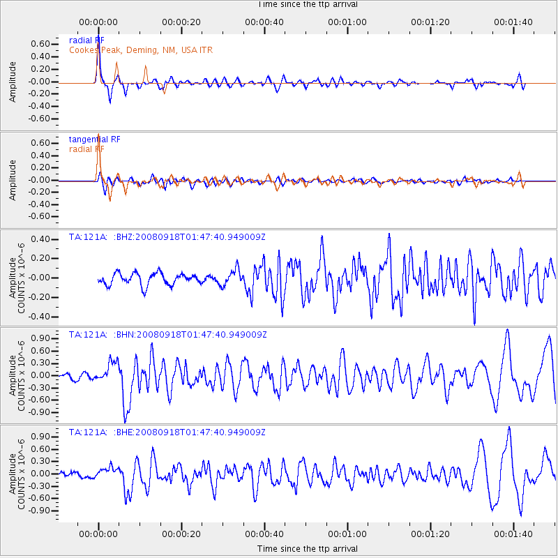
121A Cookes Peak, Deming, NM, USA - Earthquake Result Viewer
*The percent match for this event was below the threshold and hence no stack was calculated.
| Earthquake location: |
Central East Pacific Rise |
| Earthquake latitude/longitude: |
-4.6/-106.0 |
| Earthquake time(UTC): |
2008/09/18 (262) 01:41:02 GMT |
| Earthquake Depth: |
10 km |
| Earthquake Magnitude: |
5.5 MB, 5.7 MS, 6.0 MW, 6.0 MW |
| Earthquake Catalog/Contributor: |
WHDF/NEIC |
|
| Network: |
TA USArray Transportable Network (new EarthScope stations) |
| Station: |
121A Cookes Peak, Deming, NM, USA |
| Lat/Lon: |
32.53 N/107.79 W |
| Elevation: |
1652 m |
|
| Distance: |
36.9 deg |
| Az: |
357.489 deg |
| Baz: |
177.037 deg |
| Ray Param: |
$rayparam |
*The percent match for this event was below the threshold and hence was not used in the summary stack. |
|
| Radial Match: |
78.01675 % |
| Radial Bump: |
400 |
| Transverse Match: |
59.87723 % |
| Transverse Bump: |
400 |
| SOD ConfigId: |
2560 |
| Insert Time: |
2010-03-06 17:25:42.126 +0000 |
| GWidth: |
2.5 |
| Max Bumps: |
400 |
| Tol: |
0.001 |
|
Signal To Noise
| Channel | StoN | STA | LTA |
| TA:121A: :BHN:20080918T01:47:40.949009Z | 3.834644 | 2.6544836E-7 | 6.922373E-8 |
| TA:121A: :BHE:20080918T01:47:40.949009Z | 2.6062236 | 1.4279117E-7 | 5.4788536E-8 |
| TA:121A: :BHZ:20080918T01:47:40.949009Z | 1.3845453 | 8.367005E-8 | 6.043143E-8 |
| Arrivals |
| Ps | |
| PpPs | |
| PsPs/PpSs | |


