You are here: Home > Network List > TA - USArray Transportable Network (new EarthScope stations) Stations List
> Station R33M Jennings River, BC, CAN > Earthquake Result Viewer
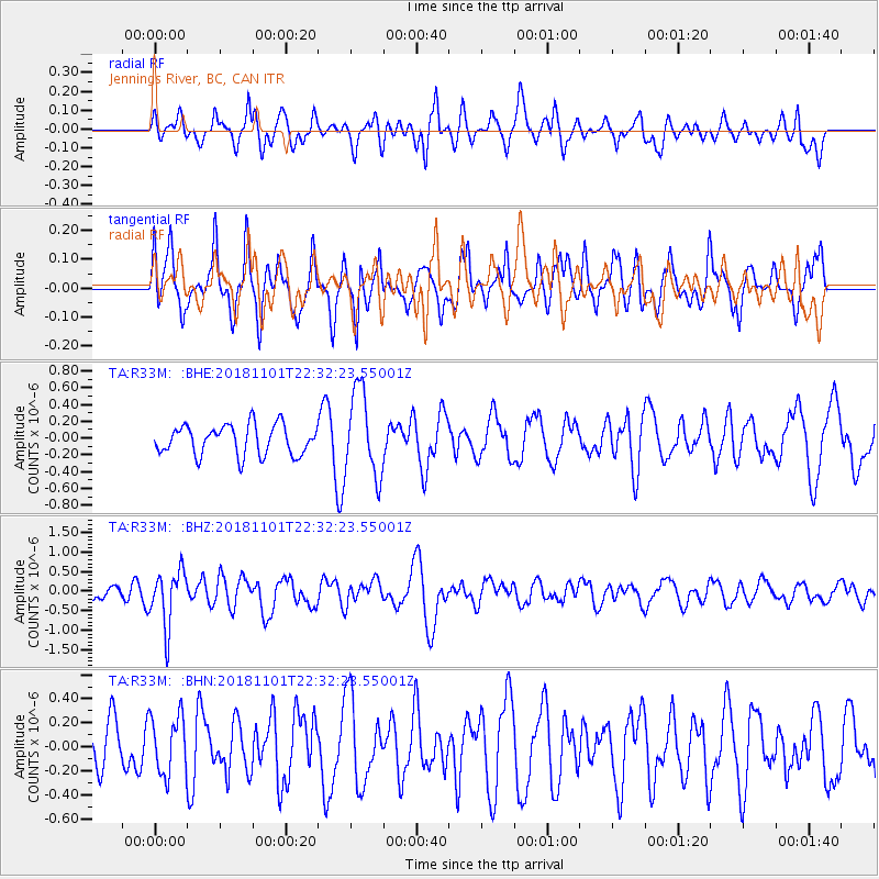
R33M Jennings River, BC, CAN - Earthquake Result Viewer
*The percent match for this event was below the threshold and hence no stack was calculated.
| Earthquake location: |
Northern Chile |
| Earthquake latitude/longitude: |
-19.6/-69.3 |
| Earthquake time(UTC): |
2018/11/01 (305) 22:19:51 GMT |
| Earthquake Depth: |
102 km |
| Earthquake Magnitude: |
6.2 Mww |
| Earthquake Catalog/Contributor: |
NEIC PDE/us |
|
| Network: |
TA USArray Transportable Network (new EarthScope stations) |
| Station: |
R33M Jennings River, BC, CAN |
| Lat/Lon: |
59.39 N/130.97 W |
| Elevation: |
1437 m |
|
| Distance: |
93.3 deg |
| Az: |
333.183 deg |
| Baz: |
123.765 deg |
| Ray Param: |
$rayparam |
*The percent match for this event was below the threshold and hence was not used in the summary stack. |
|
| Radial Match: |
51.512375 % |
| Radial Bump: |
400 |
| Transverse Match: |
74.04808 % |
| Transverse Bump: |
400 |
| SOD ConfigId: |
13570011 |
| Insert Time: |
2019-05-01 17:10:37.372 +0000 |
| GWidth: |
2.5 |
| Max Bumps: |
400 |
| Tol: |
0.001 |
|
Signal To Noise
| Channel | StoN | STA | LTA |
| TA:R33M: :BHZ:20181101T22:32:23.55001Z | 5.185656 | 7.106685E-7 | 1.3704505E-7 |
| TA:R33M: :BHN:20181101T22:32:23.55001Z | 1.2870656 | 2.4366977E-7 | 1.8932197E-7 |
| TA:R33M: :BHE:20181101T22:32:23.55001Z | 2.8827941 | 5.084938E-7 | 1.7638922E-7 |
| Arrivals |
| Ps | |
| PpPs | |
| PsPs/PpSs | |


