You are here: Home > Network List > AK - Alaska Regional Network Stations List
> Station CUT Chulitna, AK, USA > Earthquake Result Viewer
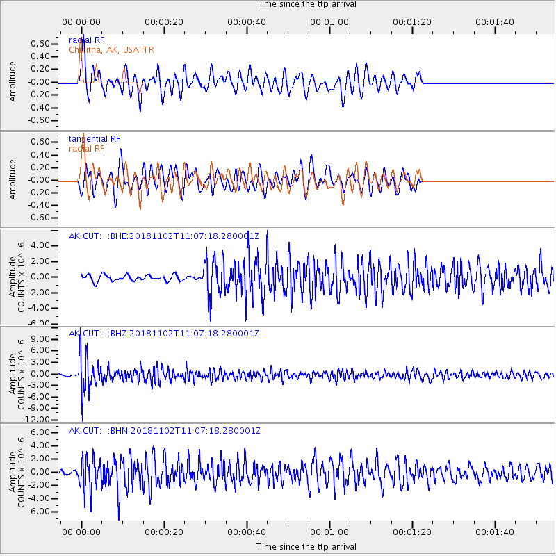
CUT Chulitna, AK, USA - Earthquake Result Viewer
*The percent match for this event was below the threshold and hence no stack was calculated.
| Earthquake location: |
Northwest Of Kuril Islands |
| Earthquake latitude/longitude: |
47.8/146.7 |
| Earthquake time(UTC): |
2018/11/02 (306) 11:01:15 GMT |
| Earthquake Depth: |
432 km |
| Earthquake Magnitude: |
5.9 Mww |
| Earthquake Catalog/Contributor: |
NEIC PDE/us |
|
| Network: |
AK Alaska Regional Network |
| Station: |
CUT Chulitna, AK, USA |
| Lat/Lon: |
62.41 N/150.26 W |
| Elevation: |
574 m |
|
| Distance: |
37.2 deg |
| Az: |
43.298 deg |
| Baz: |
276.967 deg |
| Ray Param: |
$rayparam |
*The percent match for this event was below the threshold and hence was not used in the summary stack. |
|
| Radial Match: |
71.451935 % |
| Radial Bump: |
400 |
| Transverse Match: |
65.628174 % |
| Transverse Bump: |
400 |
| SOD ConfigId: |
13570011 |
| Insert Time: |
2019-05-01 17:15:28.854 +0000 |
| GWidth: |
2.5 |
| Max Bumps: |
400 |
| Tol: |
0.001 |
|
Signal To Noise
| Channel | StoN | STA | LTA |
| AK:CUT: :BHZ:20181102T11:07:18.280001Z | 14.5372925 | 4.5090283E-6 | 3.1016975E-7 |
| AK:CUT: :BHN:20181102T11:07:18.280001Z | 4.686159 | 2.24594E-6 | 4.7927097E-7 |
| AK:CUT: :BHE:20181102T11:07:18.280001Z | 6.0227547 | 2.2971376E-6 | 3.8140976E-7 |
| Arrivals |
| Ps | |
| PpPs | |
| PsPs/PpSs | |


