You are here: Home > Network List > AV - Alaska Volcano Observatory Stations List
> Station PLBL Mt. Peulik Volcano, Alaska > Earthquake Result Viewer
PLBL Mt. Peulik Volcano, Alaska - Earthquake Result Viewer
*The percent match for this event was below the threshold and hence no stack was calculated.
| Earthquake location: |
Northwest Of Kuril Islands |
| Earthquake latitude/longitude: |
47.8/146.7 |
| Earthquake time(UTC): |
2018/11/02 (306) 11:01:15 GMT |
| Earthquake Depth: |
432 km |
| Earthquake Magnitude: |
5.9 Mww |
| Earthquake Catalog/Contributor: |
NEIC PDE/us |
|
| Network: |
AV Alaska Volcano Observatory |
| Station: |
PLBL Mt. Peulik Volcano, Alaska |
| Lat/Lon: |
57.70 N/156.82 W |
| Elevation: |
461 m |
|
| Distance: |
34.6 deg |
| Az: |
52.018 deg |
| Baz: |
278.356 deg |
| Ray Param: |
$rayparam |
*The percent match for this event was below the threshold and hence was not used in the summary stack. |
|
| Radial Match: |
64.156 % |
| Radial Bump: |
400 |
| Transverse Match: |
47.240395 % |
| Transverse Bump: |
400 |
| SOD ConfigId: |
13570011 |
| Insert Time: |
2019-05-01 17:17:01.744 +0000 |
| GWidth: |
2.5 |
| Max Bumps: |
400 |
| Tol: |
0.001 |
|
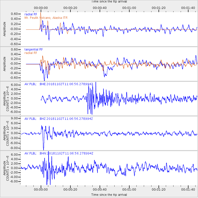
Signal To Noise
| Channel | StoN | STA | LTA |
| AV:PLBL: :BHZ:20181102T11:06:56.278994Z | 9.800223 | 3.7303594E-6 | 3.8064024E-7 |
| AV:PLBL: :BHN:20181102T11:06:56.278994Z | 3.4145317 | 2.7465308E-6 | 8.043653E-7 |
| AV:PLBL: :BHE:20181102T11:06:56.278994Z | 4.345918 | 3.0894298E-6 | 7.108808E-7 |
| Arrivals |
| Ps | |
| PpPs | |
| PsPs/PpSs | |


