You are here: Home > Network List > TA - USArray Transportable Network (new EarthScope stations) Stations List
> Station 121A Cookes Peak, Deming, NM, USA > Earthquake Result Viewer
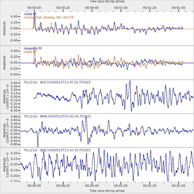
121A Cookes Peak, Deming, NM, USA - Earthquake Result Viewer
*The percent match for this event was below the threshold and hence no stack was calculated.
| Earthquake location: |
Tonga Islands |
| Earthquake latitude/longitude: |
-15.8/-173.5 |
| Earthquake time(UTC): |
2009/05/13 (133) 21:31:17 GMT |
| Earthquake Depth: |
85 km |
| Earthquake Magnitude: |
5.8 MW, 5.3 MB, 5.8 MW |
| Earthquake Catalog/Contributor: |
WHDF/NEIC |
|
| Network: |
TA USArray Transportable Network (new EarthScope stations) |
| Station: |
121A Cookes Peak, Deming, NM, USA |
| Lat/Lon: |
32.53 N/107.79 W |
| Elevation: |
1652 m |
|
| Distance: |
79.0 deg |
| Az: |
51.65 deg |
| Baz: |
243.378 deg |
| Ray Param: |
$rayparam |
*The percent match for this event was below the threshold and hence was not used in the summary stack. |
|
| Radial Match: |
62.520576 % |
| Radial Bump: |
400 |
| Transverse Match: |
56.40638 % |
| Transverse Bump: |
400 |
| SOD ConfigId: |
2760 |
| Insert Time: |
2010-03-06 17:27:00.700 +0000 |
| GWidth: |
2.5 |
| Max Bumps: |
400 |
| Tol: |
0.001 |
|
Signal To Noise
| Channel | StoN | STA | LTA |
| TA:121A: :BHN:20090513T21:42:41.75002Z | 5.0693283 | 2.6300887E-7 | 5.188239E-8 |
| TA:121A: :BHE:20090513T21:42:41.75002Z | 1.8962775 | 1.7355872E-7 | 9.152601E-8 |
| TA:121A: :BHZ:20090513T21:42:41.75002Z | 2.0498354 | 1.2621294E-7 | 6.157222E-8 |
| Arrivals |
| Ps | |
| PpPs | |
| PsPs/PpSs | |


