You are here: Home > Network List > CI - Caltech Regional Seismic Network Stations List
> Station BFS Mt Baldy Forest Station > Earthquake Result Viewer
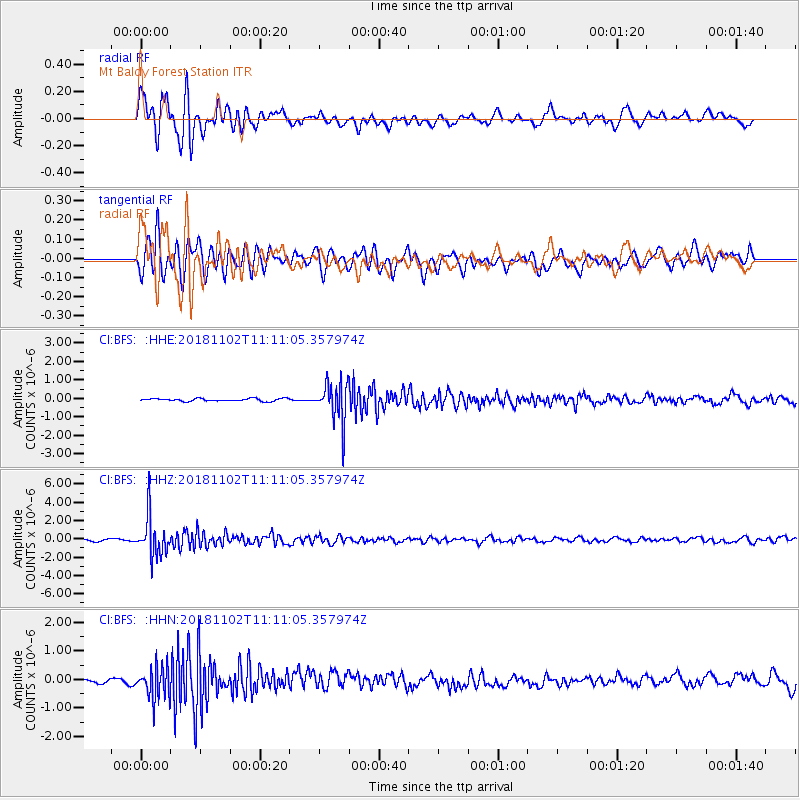
BFS Mt Baldy Forest Station - Earthquake Result Viewer
*The percent match for this event was below the threshold and hence no stack was calculated.
| Earthquake location: |
Northwest Of Kuril Islands |
| Earthquake latitude/longitude: |
47.8/146.7 |
| Earthquake time(UTC): |
2018/11/02 (306) 11:01:15 GMT |
| Earthquake Depth: |
432 km |
| Earthquake Magnitude: |
5.9 Mww |
| Earthquake Catalog/Contributor: |
NEIC PDE/us |
|
| Network: |
CI Caltech Regional Seismic Network |
| Station: |
BFS Mt Baldy Forest Station |
| Lat/Lon: |
34.24 N/117.66 W |
| Elevation: |
1312 m |
|
| Distance: |
69.0 deg |
| Az: |
62.051 deg |
| Baz: |
314.057 deg |
| Ray Param: |
$rayparam |
*The percent match for this event was below the threshold and hence was not used in the summary stack. |
|
| Radial Match: |
80.18814 % |
| Radial Bump: |
400 |
| Transverse Match: |
74.65547 % |
| Transverse Bump: |
400 |
| SOD ConfigId: |
13570011 |
| Insert Time: |
2019-05-01 17:18:26.626 +0000 |
| GWidth: |
2.5 |
| Max Bumps: |
400 |
| Tol: |
0.001 |
|
Signal To Noise
| Channel | StoN | STA | LTA |
| CI:BFS: :HHZ:20181102T11:11:05.357974Z | 19.063 | 2.1085452E-6 | 1.1060931E-7 |
| CI:BFS: :HHN:20181102T11:11:05.357974Z | 8.724461 | 5.671781E-7 | 6.5010106E-8 |
| CI:BFS: :HHE:20181102T11:11:05.357974Z | 15.27132 | 1.0601506E-6 | 6.942102E-8 |
| Arrivals |
| Ps | |
| PpPs | |
| PsPs/PpSs | |


