You are here: Home > Network List > CI - Caltech Regional Seismic Network Stations List
> Station GSC Goldstone, Goldstone Lake, CA, USA > Earthquake Result Viewer
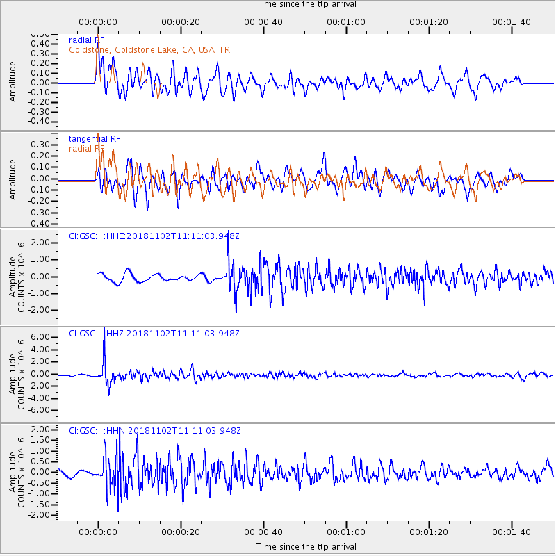
GSC Goldstone, Goldstone Lake, CA, USA - Earthquake Result Viewer
*The percent match for this event was below the threshold and hence no stack was calculated.
| Earthquake location: |
Northwest Of Kuril Islands |
| Earthquake latitude/longitude: |
47.8/146.7 |
| Earthquake time(UTC): |
2018/11/02 (306) 11:01:15 GMT |
| Earthquake Depth: |
432 km |
| Earthquake Magnitude: |
5.9 Mww |
| Earthquake Catalog/Contributor: |
NEIC PDE/us |
|
| Network: |
CI Caltech Regional Seismic Network |
| Station: |
GSC Goldstone, Goldstone Lake, CA, USA |
| Lat/Lon: |
35.30 N/116.81 W |
| Elevation: |
1000 m |
|
| Distance: |
68.7 deg |
| Az: |
60.71 deg |
| Baz: |
314.057 deg |
| Ray Param: |
$rayparam |
*The percent match for this event was below the threshold and hence was not used in the summary stack. |
|
| Radial Match: |
77.322845 % |
| Radial Bump: |
400 |
| Transverse Match: |
74.01046 % |
| Transverse Bump: |
400 |
| SOD ConfigId: |
13570011 |
| Insert Time: |
2019-05-01 17:18:41.728 +0000 |
| GWidth: |
2.5 |
| Max Bumps: |
400 |
| Tol: |
0.001 |
|
Signal To Noise
| Channel | StoN | STA | LTA |
| CI:GSC: :HHZ:20181102T11:11:03.948Z | 17.791073 | 1.9484692E-6 | 1.0951948E-7 |
| CI:GSC: :HHN:20181102T11:11:03.948Z | 4.476804 | 7.2792125E-7 | 1.6259844E-7 |
| CI:GSC: :HHE:20181102T11:11:03.948Z | 3.7464983 | 8.184323E-7 | 2.184526E-7 |
| Arrivals |
| Ps | |
| PpPs | |
| PsPs/PpSs | |


