You are here: Home > Network List > CI - Caltech Regional Seismic Network Stations List
> Station MPP McPhearson Peak > Earthquake Result Viewer
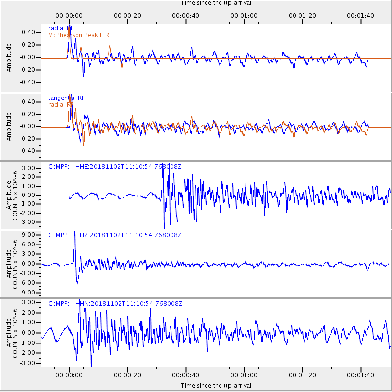
MPP McPhearson Peak - Earthquake Result Viewer
*The percent match for this event was below the threshold and hence no stack was calculated.
| Earthquake location: |
Northwest Of Kuril Islands |
| Earthquake latitude/longitude: |
47.8/146.7 |
| Earthquake time(UTC): |
2018/11/02 (306) 11:01:15 GMT |
| Earthquake Depth: |
432 km |
| Earthquake Magnitude: |
5.9 Mww |
| Earthquake Catalog/Contributor: |
NEIC PDE/us |
|
| Network: |
CI Caltech Regional Seismic Network |
| Station: |
MPP McPhearson Peak |
| Lat/Lon: |
34.89 N/119.81 W |
| Elevation: |
1739 m |
|
| Distance: |
67.2 deg |
| Az: |
62.867 deg |
| Baz: |
313.144 deg |
| Ray Param: |
$rayparam |
*The percent match for this event was below the threshold and hence was not used in the summary stack. |
|
| Radial Match: |
84.65812 % |
| Radial Bump: |
400 |
| Transverse Match: |
81.931625 % |
| Transverse Bump: |
400 |
| SOD ConfigId: |
13570011 |
| Insert Time: |
2019-05-01 17:18:52.162 +0000 |
| GWidth: |
2.5 |
| Max Bumps: |
400 |
| Tol: |
0.001 |
|
Signal To Noise
| Channel | StoN | STA | LTA |
| CI:MPP: :HHZ:20181102T11:10:54.768008Z | 17.454023 | 3.2983423E-6 | 1.8897317E-7 |
| CI:MPP: :HHN:20181102T11:10:54.768008Z | 5.735929 | 1.3199407E-6 | 2.3011803E-7 |
| CI:MPP: :HHE:20181102T11:10:54.768008Z | 7.735809 | 1.6175616E-6 | 2.091005E-7 |
| Arrivals |
| Ps | |
| PpPs | |
| PsPs/PpSs | |


