You are here: Home > Network List > CI - Caltech Regional Seismic Network Stations List
> Station SMM Simmler, CA, USA > Earthquake Result Viewer
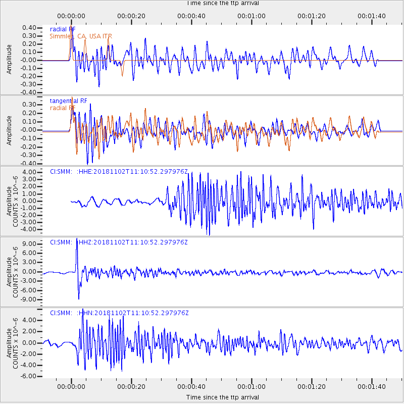
SMM Simmler, CA, USA - Earthquake Result Viewer
*The percent match for this event was below the threshold and hence no stack was calculated.
| Earthquake location: |
Northwest Of Kuril Islands |
| Earthquake latitude/longitude: |
47.8/146.7 |
| Earthquake time(UTC): |
2018/11/02 (306) 11:01:15 GMT |
| Earthquake Depth: |
432 km |
| Earthquake Magnitude: |
5.9 Mww |
| Earthquake Catalog/Contributor: |
NEIC PDE/us |
|
| Network: |
CI Caltech Regional Seismic Network |
| Station: |
SMM Simmler, CA, USA |
| Lat/Lon: |
35.31 N/120.00 W |
| Elevation: |
599 m |
|
| Distance: |
66.8 deg |
| Az: |
62.64 deg |
| Baz: |
312.951 deg |
| Ray Param: |
$rayparam |
*The percent match for this event was below the threshold and hence was not used in the summary stack. |
|
| Radial Match: |
77.13978 % |
| Radial Bump: |
400 |
| Transverse Match: |
74.16276 % |
| Transverse Bump: |
400 |
| SOD ConfigId: |
13570011 |
| Insert Time: |
2019-05-01 17:19:06.845 +0000 |
| GWidth: |
2.5 |
| Max Bumps: |
400 |
| Tol: |
0.001 |
|
Signal To Noise
| Channel | StoN | STA | LTA |
| CI:SMM: :HHZ:20181102T11:10:52.297976Z | 16.019241 | 3.7477005E-6 | 2.3394995E-7 |
| CI:SMM: :HHN:20181102T11:10:52.297976Z | 6.5002127 | 2.2684221E-6 | 3.4897658E-7 |
| CI:SMM: :HHE:20181102T11:10:52.297976Z | 2.6210217 | 8.607145E-7 | 3.2838892E-7 |
| Arrivals |
| Ps | |
| PpPs | |
| PsPs/PpSs | |


