You are here: Home > Network List > CN - Canadian National Seismograph Network Stations List
> Station INK INUVIK, NT > Earthquake Result Viewer
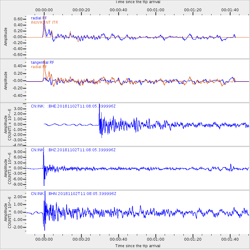
INK INUVIK, NT - Earthquake Result Viewer
*The percent match for this event was below the threshold and hence no stack was calculated.
| Earthquake location: |
Northwest Of Kuril Islands |
| Earthquake latitude/longitude: |
47.8/146.7 |
| Earthquake time(UTC): |
2018/11/02 (306) 11:01:15 GMT |
| Earthquake Depth: |
432 km |
| Earthquake Magnitude: |
5.9 Mww |
| Earthquake Catalog/Contributor: |
NEIC PDE/us |
|
| Network: |
CN Canadian National Seismograph Network |
| Station: |
INK INUVIK, NT |
| Lat/Lon: |
68.31 N/133.53 W |
| Elevation: |
44 m |
|
| Distance: |
43.1 deg |
| Az: |
32.386 deg |
| Baz: |
283.84 deg |
| Ray Param: |
$rayparam |
*The percent match for this event was below the threshold and hence was not used in the summary stack. |
|
| Radial Match: |
76.39542 % |
| Radial Bump: |
400 |
| Transverse Match: |
45.4721 % |
| Transverse Bump: |
400 |
| SOD ConfigId: |
13570011 |
| Insert Time: |
2019-05-01 17:19:40.287 +0000 |
| GWidth: |
2.5 |
| Max Bumps: |
400 |
| Tol: |
0.001 |
|
Signal To Noise
| Channel | StoN | STA | LTA |
| CN:INK: :BHZ:20181102T11:08:05.399996Z | 15.910792 | 2.9682074E-6 | 1.865531E-7 |
| CN:INK: :BHN:20181102T11:08:05.399996Z | 10.868274 | 7.906862E-7 | 7.2751774E-8 |
| CN:INK: :BHE:20181102T11:08:05.399996Z | 11.672828 | 1.2423825E-6 | 1.0643372E-7 |
| Arrivals |
| Ps | |
| PpPs | |
| PsPs/PpSs | |


