You are here: Home > Network List > HV - Hawaiian Volcano Observatory Network Stations List
> Station MLOD Mauna Loa, Hawaii Digital > Earthquake Result Viewer
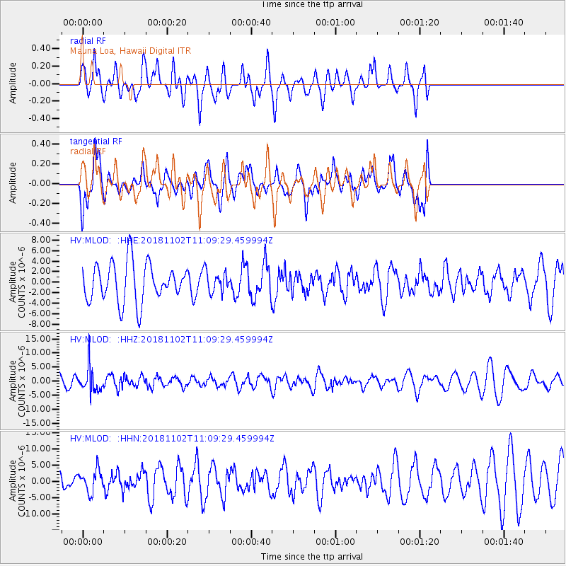
MLOD Mauna Loa, Hawaii Digital - Earthquake Result Viewer
*The percent match for this event was below the threshold and hence no stack was calculated.
| Earthquake location: |
Northwest Of Kuril Islands |
| Earthquake latitude/longitude: |
47.8/146.7 |
| Earthquake time(UTC): |
2018/11/02 (306) 11:01:15 GMT |
| Earthquake Depth: |
432 km |
| Earthquake Magnitude: |
5.9 Mww |
| Earthquake Catalog/Contributor: |
NEIC PDE/us |
|
| Network: |
HV Hawaiian Volcano Observatory Network |
| Station: |
MLOD Mauna Loa, Hawaii Digital |
| Lat/Lon: |
19.49 N/155.39 W |
| Elevation: |
2044 m |
|
| Distance: |
54.3 deg |
| Az: |
100.411 deg |
| Baz: |
315.359 deg |
| Ray Param: |
$rayparam |
*The percent match for this event was below the threshold and hence was not used in the summary stack. |
|
| Radial Match: |
60.99617 % |
| Radial Bump: |
400 |
| Transverse Match: |
67.33965 % |
| Transverse Bump: |
400 |
| SOD ConfigId: |
13570011 |
| Insert Time: |
2019-05-01 17:21:11.603 +0000 |
| GWidth: |
2.5 |
| Max Bumps: |
400 |
| Tol: |
0.001 |
|
Signal To Noise
| Channel | StoN | STA | LTA |
| HV:MLOD: :HHZ:20181102T11:09:29.459994Z | 2.23007 | 4.555264E-6 | 2.0426548E-6 |
| HV:MLOD: :HHN:20181102T11:09:29.459994Z | 1.0547498 | 3.4217949E-6 | 3.244177E-6 |
| HV:MLOD: :HHE:20181102T11:09:29.459994Z | 0.5297459 | 1.947666E-6 | 3.6766044E-6 |
| Arrivals |
| Ps | |
| PpPs | |
| PsPs/PpSs | |


