You are here: Home > Network List > TA - USArray Transportable Network (new EarthScope stations) Stations List
> Station V17A Tonalea, Kykotsmovi, AZ, USA > Earthquake Result Viewer
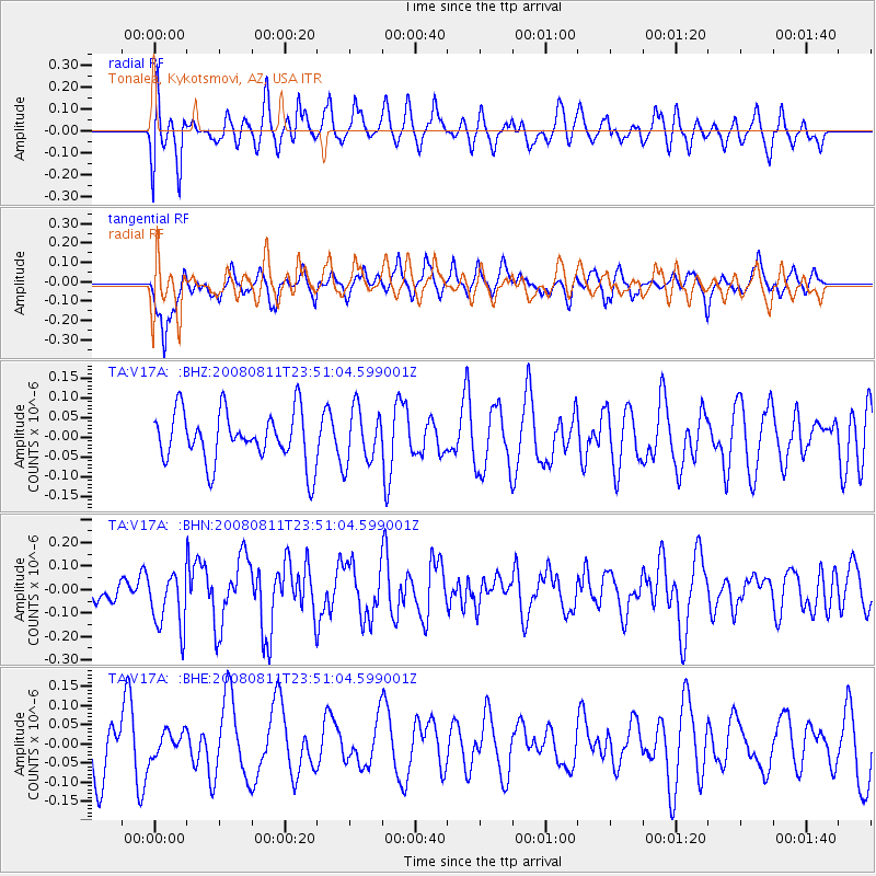
V17A Tonalea, Kykotsmovi, AZ, USA - Earthquake Result Viewer
*The percent match for this event was below the threshold and hence no stack was calculated.
| Earthquake location: |
Central Mid-Atlantic Ridge |
| Earthquake latitude/longitude: |
-1.0/-21.8 |
| Earthquake time(UTC): |
2008/08/11 (224) 23:38:38 GMT |
| Earthquake Depth: |
13 km |
| Earthquake Magnitude: |
6.0 MW, 5.2 MS, 5.4 MB, 6.0 MW |
| Earthquake Catalog/Contributor: |
WHDF/NEIC |
|
| Network: |
TA USArray Transportable Network (new EarthScope stations) |
| Station: |
V17A Tonalea, Kykotsmovi, AZ, USA |
| Lat/Lon: |
35.62 N/110.79 W |
| Elevation: |
1596 m |
|
| Distance: |
89.7 deg |
| Az: |
305.452 deg |
| Baz: |
91.434 deg |
| Ray Param: |
$rayparam |
*The percent match for this event was below the threshold and hence was not used in the summary stack. |
|
| Radial Match: |
62.371056 % |
| Radial Bump: |
400 |
| Transverse Match: |
66.85786 % |
| Transverse Bump: |
388 |
| SOD ConfigId: |
2504 |
| Insert Time: |
2010-03-06 17:28:22.926 +0000 |
| GWidth: |
2.5 |
| Max Bumps: |
400 |
| Tol: |
0.001 |
|
Signal To Noise
| Channel | StoN | STA | LTA |
| TA:V17A: :BHN:20080811T23:51:04.599001Z | 2.3920982 | 1.2216037E-7 | 5.1068294E-8 |
| TA:V17A: :BHE:20080811T23:51:04.599001Z | 0.41448414 | 3.1683715E-8 | 7.644132E-8 |
| TA:V17A: :BHZ:20080811T23:51:04.599001Z | 1.0585784 | 6.867043E-8 | 6.487043E-8 |
| Arrivals |
| Ps | |
| PpPs | |
| PsPs/PpSs | |


