You are here: Home > Network List > TA - USArray Transportable Network (new EarthScope stations) Stations List
> Station V17A Tonalea, Kykotsmovi, AZ, USA > Earthquake Result Viewer
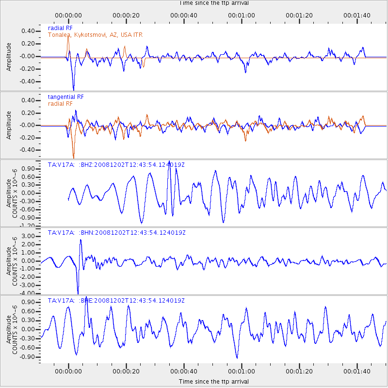
V17A Tonalea, Kykotsmovi, AZ, USA - Earthquake Result Viewer
*The percent match for this event was below the threshold and hence no stack was calculated.
| Earthquake location: |
Mariana Islands |
| Earthquake latitude/longitude: |
19.1/145.8 |
| Earthquake time(UTC): |
2008/12/02 (337) 12:31:43 GMT |
| Earthquake Depth: |
137 km |
| Earthquake Magnitude: |
5.9 MB, 5.9 MW, 5.9 MW |
| Earthquake Catalog/Contributor: |
WHDF/NEIC |
|
| Network: |
TA USArray Transportable Network (new EarthScope stations) |
| Station: |
V17A Tonalea, Kykotsmovi, AZ, USA |
| Lat/Lon: |
35.62 N/110.79 W |
| Elevation: |
1596 m |
|
| Distance: |
89.5 deg |
| Az: |
52.41 deg |
| Baz: |
293.123 deg |
| Ray Param: |
$rayparam |
*The percent match for this event was below the threshold and hence was not used in the summary stack. |
|
| Radial Match: |
65.76285 % |
| Radial Bump: |
364 |
| Transverse Match: |
56.18603 % |
| Transverse Bump: |
271 |
| SOD ConfigId: |
2658 |
| Insert Time: |
2010-03-06 17:29:00.515 +0000 |
| GWidth: |
2.5 |
| Max Bumps: |
400 |
| Tol: |
0.001 |
|
Signal To Noise
| Channel | StoN | STA | LTA |
| TA:V17A: :BHN:20081202T12:43:54.124019Z | 6.8962917 | 1.4929941E-6 | 2.1649231E-7 |
| TA:V17A: :BHE:20081202T12:43:54.124019Z | 1.8677082 | 5.3035257E-7 | 2.8395903E-7 |
| TA:V17A: :BHZ:20081202T12:43:54.124019Z | 1.5032432 | 4.86179E-7 | 3.2342004E-7 |
| Arrivals |
| Ps | |
| PpPs | |
| PsPs/PpSs | |


