You are here: Home > Network List > TA - USArray Transportable Network (new EarthScope stations) Stations List
> Station B18K Kokolik River, AK, USA > Earthquake Result Viewer
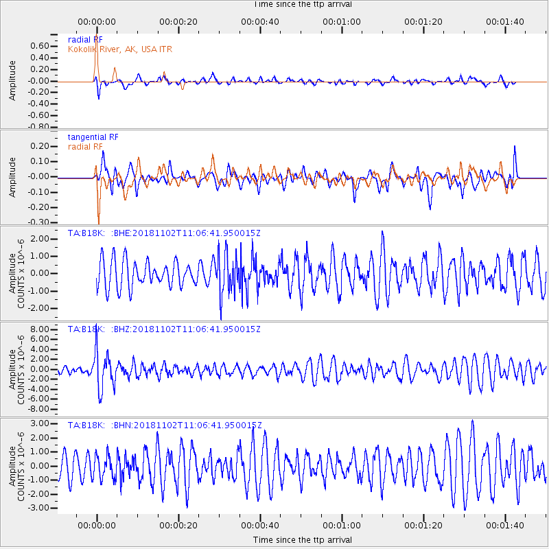
B18K Kokolik River, AK, USA - Earthquake Result Viewer
*The percent match for this event was below the threshold and hence no stack was calculated.
| Earthquake location: |
Northwest Of Kuril Islands |
| Earthquake latitude/longitude: |
47.8/146.7 |
| Earthquake time(UTC): |
2018/11/02 (306) 11:01:15 GMT |
| Earthquake Depth: |
432 km |
| Earthquake Magnitude: |
5.9 Mww |
| Earthquake Catalog/Contributor: |
NEIC PDE/us |
|
| Network: |
TA USArray Transportable Network (new EarthScope stations) |
| Station: |
B18K Kokolik River, AK, USA |
| Lat/Lon: |
69.36 N/161.80 W |
| Elevation: |
222 m |
|
| Distance: |
32.9 deg |
| Az: |
30.701 deg |
| Baz: |
256.09 deg |
| Ray Param: |
$rayparam |
*The percent match for this event was below the threshold and hence was not used in the summary stack. |
|
| Radial Match: |
64.32312 % |
| Radial Bump: |
400 |
| Transverse Match: |
31.289755 % |
| Transverse Bump: |
400 |
| SOD ConfigId: |
13570011 |
| Insert Time: |
2019-05-01 17:27:39.167 +0000 |
| GWidth: |
2.5 |
| Max Bumps: |
400 |
| Tol: |
0.001 |
|
Signal To Noise
| Channel | StoN | STA | LTA |
| TA:B18K: :BHZ:20181102T11:06:41.950015Z | 3.258253 | 3.8025998E-6 | 1.167067E-6 |
| TA:B18K: :BHN:20181102T11:06:41.950015Z | 0.6404612 | 8.11218E-7 | 1.2666153E-6 |
| TA:B18K: :BHE:20181102T11:06:41.950015Z | 1.5146717 | 1.1250402E-6 | 7.427617E-7 |
| Arrivals |
| Ps | |
| PpPs | |
| PsPs/PpSs | |


