You are here: Home > Network List > IU - Global Seismograph Network (GSN - IRIS/USGS) Stations List
> Station SLBS Sierra la Laguna Baja California Sur, Mexico > Earthquake Result Viewer
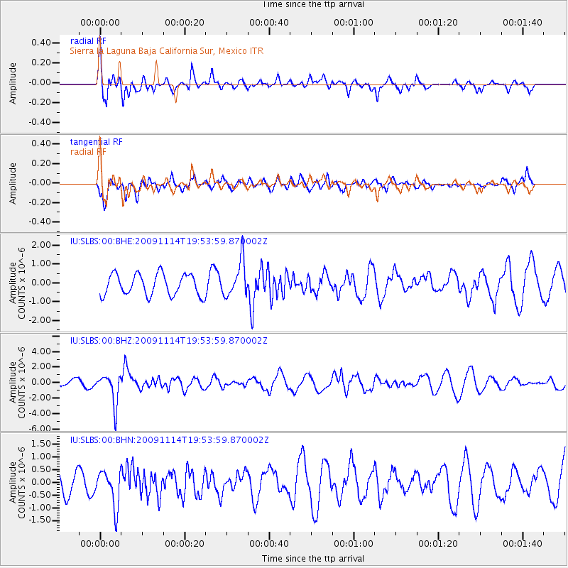
SLBS Sierra la Laguna Baja California Sur, Mexico - Earthquake Result Viewer
*The percent match for this event was below the threshold and hence no stack was calculated.
| Earthquake location: |
Jujuy Province, Argentina |
| Earthquake latitude/longitude: |
-23.0/-66.6 |
| Earthquake time(UTC): |
2009/11/14 (318) 19:44:29 GMT |
| Earthquake Depth: |
220 km |
| Earthquake Magnitude: |
5.8 MB, 6.2 MW, 6.1 MW |
| Earthquake Catalog/Contributor: |
WHDF/NEIC |
|
| Network: |
IU Global Seismograph Network (GSN - IRIS/USGS) |
| Station: |
SLBS Sierra la Laguna Baja California Sur, Mexico |
| Lat/Lon: |
23.69 N/109.94 W |
| Elevation: |
825 m |
|
| Distance: |
62.6 deg |
| Az: |
314.919 deg |
| Baz: |
134.61 deg |
| Ray Param: |
$rayparam |
*The percent match for this event was below the threshold and hence was not used in the summary stack. |
|
| Radial Match: |
60.44666 % |
| Radial Bump: |
400 |
| Transverse Match: |
66.237236 % |
| Transverse Bump: |
400 |
| SOD ConfigId: |
1 |
| Insert Time: |
2010-02-19 01:12:05.936 +0000 |
| GWidth: |
2.5 |
| Max Bumps: |
400 |
| Tol: |
0.001 |
|
Signal To Noise
| Channel | StoN | STA | LTA |
| IU:SLBS:00:BHZ:20091114T19:53:59.870002Z | 2.4383063 | 2.0251014E-6 | 8.3053607E-7 |
| IU:SLBS:00:BHN:20091114T19:53:59.870002Z | 1.1525158 | 7.404829E-7 | 6.4249264E-7 |
| IU:SLBS:00:BHE:20091114T19:53:59.870002Z | 1.7162226 | 9.702967E-7 | 5.653676E-7 |
| Arrivals |
| Ps | |
| PpPs | |
| PsPs/PpSs | |


