You are here: Home > Network List > TA - USArray Transportable Network (new EarthScope stations) Stations List
> Station D25K Kavik River, AK, USA > Earthquake Result Viewer
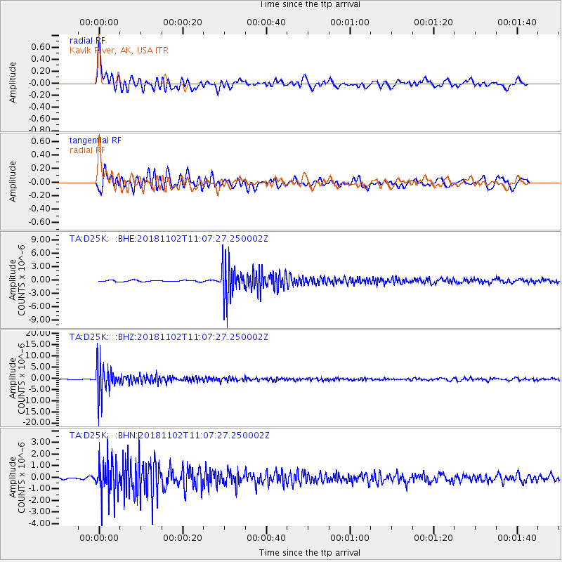
D25K Kavik River, AK, USA - Earthquake Result Viewer
*The percent match for this event was below the threshold and hence no stack was calculated.
| Earthquake location: |
Northwest Of Kuril Islands |
| Earthquake latitude/longitude: |
47.8/146.7 |
| Earthquake time(UTC): |
2018/11/02 (306) 11:01:15 GMT |
| Earthquake Depth: |
432 km |
| Earthquake Magnitude: |
5.9 Mww |
| Earthquake Catalog/Contributor: |
NEIC PDE/us |
|
| Network: |
TA USArray Transportable Network (new EarthScope stations) |
| Station: |
D25K Kavik River, AK, USA |
| Lat/Lon: |
69.32 N/146.38 W |
| Elevation: |
770 m |
|
| Distance: |
38.3 deg |
| Az: |
31.793 deg |
| Baz: |
271.412 deg |
| Ray Param: |
$rayparam |
*The percent match for this event was below the threshold and hence was not used in the summary stack. |
|
| Radial Match: |
71.20427 % |
| Radial Bump: |
400 |
| Transverse Match: |
78.519615 % |
| Transverse Bump: |
400 |
| SOD ConfigId: |
13570011 |
| Insert Time: |
2019-05-01 17:27:54.222 +0000 |
| GWidth: |
2.5 |
| Max Bumps: |
400 |
| Tol: |
0.001 |
|
Signal To Noise
| Channel | StoN | STA | LTA |
| TA:D25K: :BHZ:20181102T11:07:27.250002Z | 44.6983 | 6.32044E-6 | 1.4140225E-7 |
| TA:D25K: :BHN:20181102T11:07:27.250002Z | 10.408324 | 1.4552298E-6 | 1.3981403E-7 |
| TA:D25K: :BHE:20181102T11:07:27.250002Z | 22.82757 | 3.5279024E-6 | 1.5454569E-7 |
| Arrivals |
| Ps | |
| PpPs | |
| PsPs/PpSs | |


