You are here: Home > Network List > TA - USArray Transportable Network (new EarthScope stations) Stations List
> Station E18K Tukpahlearik Creek, AK, USA > Earthquake Result Viewer
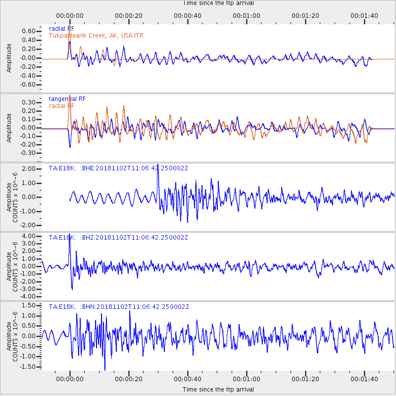
E18K Tukpahlearik Creek, AK, USA - Earthquake Result Viewer
*The percent match for this event was below the threshold and hence no stack was calculated.
| Earthquake location: |
Northwest Of Kuril Islands |
| Earthquake latitude/longitude: |
47.8/146.7 |
| Earthquake time(UTC): |
2018/11/02 (306) 11:01:15 GMT |
| Earthquake Depth: |
432 km |
| Earthquake Magnitude: |
5.9 Mww |
| Earthquake Catalog/Contributor: |
NEIC PDE/us |
|
| Network: |
TA USArray Transportable Network (new EarthScope stations) |
| Station: |
E18K Tukpahlearik Creek, AK, USA |
| Lat/Lon: |
67.42 N/160.60 W |
| Elevation: |
297 m |
|
| Distance: |
32.9 deg |
| Az: |
34.385 deg |
| Baz: |
260.296 deg |
| Ray Param: |
$rayparam |
*The percent match for this event was below the threshold and hence was not used in the summary stack. |
|
| Radial Match: |
70.36939 % |
| Radial Bump: |
400 |
| Transverse Match: |
52.189137 % |
| Transverse Bump: |
400 |
| SOD ConfigId: |
13570011 |
| Insert Time: |
2019-05-01 17:27:56.511 +0000 |
| GWidth: |
2.5 |
| Max Bumps: |
400 |
| Tol: |
0.001 |
|
Signal To Noise
| Channel | StoN | STA | LTA |
| TA:E18K: :BHZ:20181102T11:06:42.250002Z | 3.9514287 | 1.4719458E-6 | 3.7250976E-7 |
| TA:E18K: :BHN:20181102T11:06:42.250002Z | 1.9904103 | 5.3310055E-7 | 2.678345E-7 |
| TA:E18K: :BHE:20181102T11:06:42.250002Z | 2.676708 | 7.6295146E-7 | 2.850335E-7 |
| Arrivals |
| Ps | |
| PpPs | |
| PsPs/PpSs | |


