You are here: Home > Network List > TA - USArray Transportable Network (new EarthScope stations) Stations List
> Station G23K Bananza Creek, AK, USA > Earthquake Result Viewer
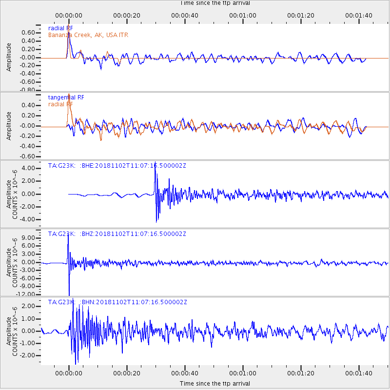
G23K Bananza Creek, AK, USA - Earthquake Result Viewer
*The percent match for this event was below the threshold and hence no stack was calculated.
| Earthquake location: |
Northwest Of Kuril Islands |
| Earthquake latitude/longitude: |
47.8/146.7 |
| Earthquake time(UTC): |
2018/11/02 (306) 11:01:15 GMT |
| Earthquake Depth: |
432 km |
| Earthquake Magnitude: |
5.9 Mww |
| Earthquake Catalog/Contributor: |
NEIC PDE/us |
|
| Network: |
TA USArray Transportable Network (new EarthScope stations) |
| Station: |
G23K Bananza Creek, AK, USA |
| Lat/Lon: |
66.71 N/150.02 W |
| Elevation: |
746 m |
|
| Distance: |
37.0 deg |
| Az: |
36.14 deg |
| Baz: |
271.472 deg |
| Ray Param: |
$rayparam |
*The percent match for this event was below the threshold and hence was not used in the summary stack. |
|
| Radial Match: |
60.696835 % |
| Radial Bump: |
400 |
| Transverse Match: |
68.68647 % |
| Transverse Bump: |
400 |
| SOD ConfigId: |
13570011 |
| Insert Time: |
2019-05-01 17:28:21.334 +0000 |
| GWidth: |
2.5 |
| Max Bumps: |
400 |
| Tol: |
0.001 |
|
Signal To Noise
| Channel | StoN | STA | LTA |
| TA:G23K: :BHZ:20181102T11:07:16.500002Z | 25.744028 | 3.3528613E-6 | 1.3023842E-7 |
| TA:G23K: :BHN:20181102T11:07:16.500002Z | 6.1852455 | 1.1906742E-6 | 1.9250233E-7 |
| TA:G23K: :BHE:20181102T11:07:16.500002Z | 11.744029 | 1.8142204E-6 | 1.5448023E-7 |
| Arrivals |
| Ps | |
| PpPs | |
| PsPs/PpSs | |


