You are here: Home > Network List > TA - USArray Transportable Network (new EarthScope stations) Stations List
> Station M16K Timber Creek, AK, USA > Earthquake Result Viewer
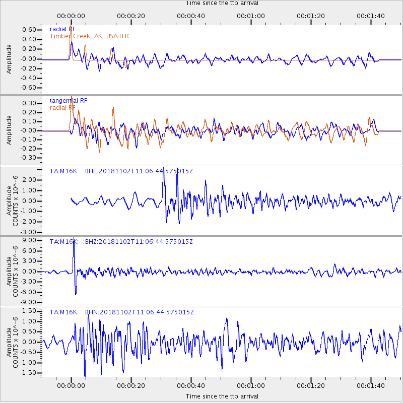
M16K Timber Creek, AK, USA - Earthquake Result Viewer
*The percent match for this event was below the threshold and hence no stack was calculated.
| Earthquake location: |
Northwest Of Kuril Islands |
| Earthquake latitude/longitude: |
47.8/146.7 |
| Earthquake time(UTC): |
2018/11/02 (306) 11:01:15 GMT |
| Earthquake Depth: |
432 km |
| Earthquake Magnitude: |
5.9 Mww |
| Earthquake Catalog/Contributor: |
NEIC PDE/us |
|
| Network: |
TA USArray Transportable Network (new EarthScope stations) |
| Station: |
M16K Timber Creek, AK, USA |
| Lat/Lon: |
61.02 N/158.96 W |
| Elevation: |
394 m |
|
| Distance: |
33.2 deg |
| Az: |
46.236 deg |
| Baz: |
271.718 deg |
| Ray Param: |
$rayparam |
*The percent match for this event was below the threshold and hence was not used in the summary stack. |
|
| Radial Match: |
65.03489 % |
| Radial Bump: |
400 |
| Transverse Match: |
59.97792 % |
| Transverse Bump: |
400 |
| SOD ConfigId: |
13570011 |
| Insert Time: |
2019-05-01 17:29:24.292 +0000 |
| GWidth: |
2.5 |
| Max Bumps: |
400 |
| Tol: |
0.001 |
|
Signal To Noise
| Channel | StoN | STA | LTA |
| TA:M16K: :BHZ:20181102T11:06:44.575015Z | 13.08791 | 3.0283213E-6 | 2.3138311E-7 |
| TA:M16K: :BHN:20181102T11:06:44.575015Z | 3.0513988 | 5.6849854E-7 | 1.8630752E-7 |
| TA:M16K: :BHE:20181102T11:06:44.575015Z | 3.5838506 | 1.1429943E-6 | 3.189291E-7 |
| Arrivals |
| Ps | |
| PpPs | |
| PsPs/PpSs | |


