You are here: Home > Network List > TA - USArray Transportable Network (new EarthScope stations) Stations List
> Station N23A Red Feather Lakes, CO, USA > Earthquake Result Viewer
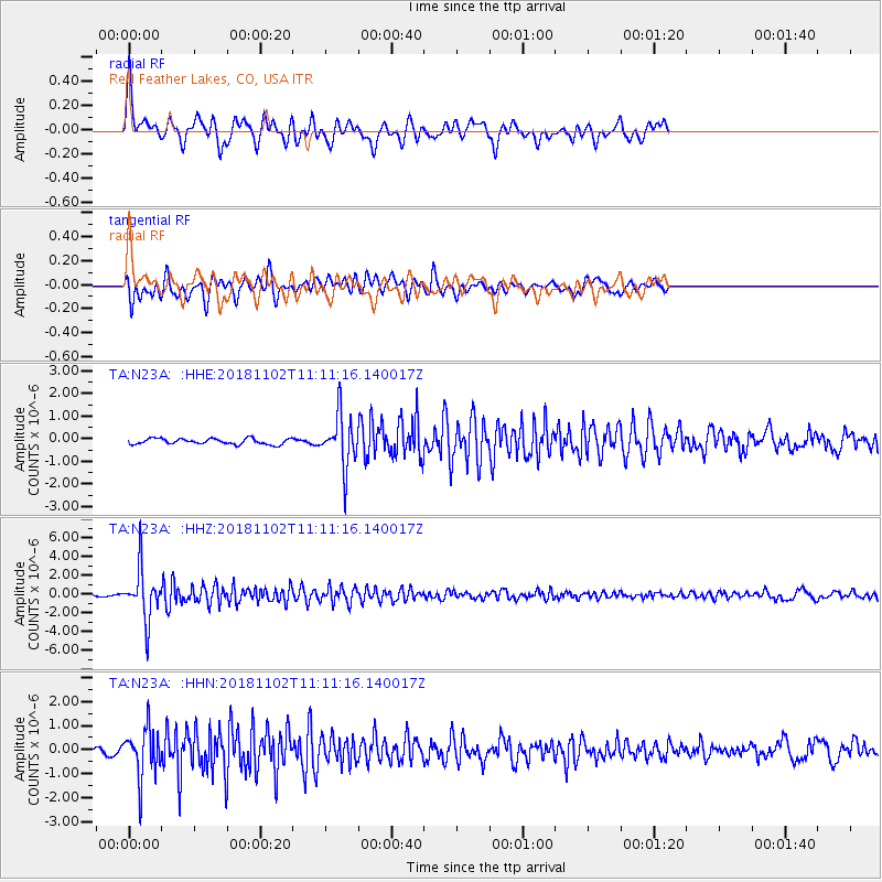
N23A Red Feather Lakes, CO, USA - Earthquake Result Viewer
*The percent match for this event was below the threshold and hence no stack was calculated.
| Earthquake location: |
Northwest Of Kuril Islands |
| Earthquake latitude/longitude: |
47.8/146.7 |
| Earthquake time(UTC): |
2018/11/02 (306) 11:01:15 GMT |
| Earthquake Depth: |
432 km |
| Earthquake Magnitude: |
5.9 Mww |
| Earthquake Catalog/Contributor: |
NEIC PDE/us |
|
| Network: |
TA USArray Transportable Network (new EarthScope stations) |
| Station: |
N23A Red Feather Lakes, CO, USA |
| Lat/Lon: |
40.89 N/105.94 W |
| Elevation: |
2458 m |
|
| Distance: |
70.8 deg |
| Az: |
50.036 deg |
| Baz: |
317.046 deg |
| Ray Param: |
$rayparam |
*The percent match for this event was below the threshold and hence was not used in the summary stack. |
|
| Radial Match: |
71.5185 % |
| Radial Bump: |
400 |
| Transverse Match: |
73.45518 % |
| Transverse Bump: |
400 |
| SOD ConfigId: |
13570011 |
| Insert Time: |
2019-05-01 17:29:40.305 +0000 |
| GWidth: |
2.5 |
| Max Bumps: |
400 |
| Tol: |
0.001 |
|
Signal To Noise
| Channel | StoN | STA | LTA |
| TA:N23A: :HHZ:20181102T11:11:16.140017Z | 18.814322 | 2.6879031E-6 | 1.4286474E-7 |
| TA:N23A: :HHN:20181102T11:11:16.140017Z | 5.722312 | 1.0181972E-6 | 1.7793457E-7 |
| TA:N23A: :HHE:20181102T11:11:16.140017Z | 9.3017435 | 1.1597291E-6 | 1.2467868E-7 |
| Arrivals |
| Ps | |
| PpPs | |
| PsPs/PpSs | |


