You are here: Home > Network List > TA - USArray Transportable Network (new EarthScope stations) Stations List
> Station R32K Eaglecrest, AK, USA > Earthquake Result Viewer
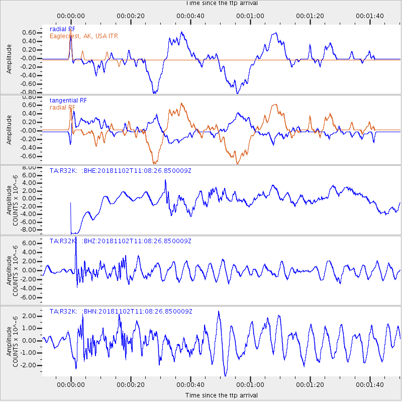
R32K Eaglecrest, AK, USA - Earthquake Result Viewer
*The percent match for this event was below the threshold and hence no stack was calculated.
| Earthquake location: |
Northwest Of Kuril Islands |
| Earthquake latitude/longitude: |
47.8/146.7 |
| Earthquake time(UTC): |
2018/11/02 (306) 11:01:15 GMT |
| Earthquake Depth: |
432 km |
| Earthquake Magnitude: |
5.9 Mww |
| Earthquake Catalog/Contributor: |
NEIC PDE/us |
|
| Network: |
TA USArray Transportable Network (new EarthScope stations) |
| Station: |
R32K Eaglecrest, AK, USA |
| Lat/Lon: |
58.27 N/134.52 W |
| Elevation: |
386 m |
|
| Distance: |
45.8 deg |
| Az: |
46.25 deg |
| Baz: |
292.872 deg |
| Ray Param: |
$rayparam |
*The percent match for this event was below the threshold and hence was not used in the summary stack. |
|
| Radial Match: |
18.221184 % |
| Radial Bump: |
400 |
| Transverse Match: |
23.335215 % |
| Transverse Bump: |
400 |
| SOD ConfigId: |
13570011 |
| Insert Time: |
2019-05-01 17:30:09.414 +0000 |
| GWidth: |
2.5 |
| Max Bumps: |
400 |
| Tol: |
0.001 |
|
Signal To Noise
| Channel | StoN | STA | LTA |
| TA:R32K: :BHZ:20181102T11:08:26.850009Z | 2.115053 | 1.9877593E-6 | 9.398154E-7 |
| TA:R32K: :BHN:20181102T11:08:26.850009Z | 2.0106022 | 1.2906012E-6 | 6.4189777E-7 |
| TA:R32K: :BHE:20181102T11:08:26.850009Z | 0.85511464 | 2.8306972E-6 | 3.310313E-6 |
| Arrivals |
| Ps | |
| PpPs | |
| PsPs/PpSs | |


