You are here: Home > Network List > TA - USArray Transportable Network (new EarthScope stations) Stations List
> Station R33M Jennings River, BC, CAN > Earthquake Result Viewer
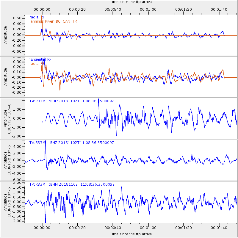
R33M Jennings River, BC, CAN - Earthquake Result Viewer
*The percent match for this event was below the threshold and hence no stack was calculated.
| Earthquake location: |
Northwest Of Kuril Islands |
| Earthquake latitude/longitude: |
47.8/146.7 |
| Earthquake time(UTC): |
2018/11/02 (306) 11:01:15 GMT |
| Earthquake Depth: |
432 km |
| Earthquake Magnitude: |
5.9 Mww |
| Earthquake Catalog/Contributor: |
NEIC PDE/us |
|
| Network: |
TA USArray Transportable Network (new EarthScope stations) |
| Station: |
R33M Jennings River, BC, CAN |
| Lat/Lon: |
59.39 N/130.97 W |
| Elevation: |
1437 m |
|
| Distance: |
47.1 deg |
| Az: |
43.813 deg |
| Baz: |
294.226 deg |
| Ray Param: |
$rayparam |
*The percent match for this event was below the threshold and hence was not used in the summary stack. |
|
| Radial Match: |
58.346977 % |
| Radial Bump: |
400 |
| Transverse Match: |
73.3508 % |
| Transverse Bump: |
400 |
| SOD ConfigId: |
13570011 |
| Insert Time: |
2019-05-01 17:30:10.446 +0000 |
| GWidth: |
2.5 |
| Max Bumps: |
400 |
| Tol: |
0.001 |
|
Signal To Noise
| Channel | StoN | STA | LTA |
| TA:R33M: :BHZ:20181102T11:08:36.350009Z | 3.9436142 | 1.7279367E-6 | 4.3816067E-7 |
| TA:R33M: :BHN:20181102T11:08:36.350009Z | 1.6006054 | 6.3905856E-7 | 3.9926056E-7 |
| TA:R33M: :BHE:20181102T11:08:36.350009Z | 1.5640258 | 6.844282E-7 | 4.3760676E-7 |
| Arrivals |
| Ps | |
| PpPs | |
| PsPs/PpSs | |


