You are here: Home > Network List > UW - Pacific Northwest Regional Seismic Network Stations List
> Station FISH Seaside, OR, USA > Earthquake Result Viewer
FISH Seaside, OR, USA - Earthquake Result Viewer
*The percent match for this event was below the threshold and hence no stack was calculated.
| Earthquake location: |
Northwest Of Kuril Islands |
| Earthquake latitude/longitude: |
47.8/146.7 |
| Earthquake time(UTC): |
2018/11/02 (306) 11:01:15 GMT |
| Earthquake Depth: |
432 km |
| Earthquake Magnitude: |
5.9 Mww |
| Earthquake Catalog/Contributor: |
NEIC PDE/us |
|
| Network: |
UW Pacific Northwest Regional Seismic Network |
| Station: |
FISH Seaside, OR, USA |
| Lat/Lon: |
45.93 N/123.56 W |
| Elevation: |
325 m |
|
| Distance: |
57.9 deg |
| Az: |
55.472 deg |
| Baz: |
307.291 deg |
| Ray Param: |
$rayparam |
*The percent match for this event was below the threshold and hence was not used in the summary stack. |
|
| Radial Match: |
41.387333 % |
| Radial Bump: |
400 |
| Transverse Match: |
31.084711 % |
| Transverse Bump: |
400 |
| SOD ConfigId: |
13570011 |
| Insert Time: |
2019-05-01 17:31:30.846 +0000 |
| GWidth: |
2.5 |
| Max Bumps: |
400 |
| Tol: |
0.001 |
|
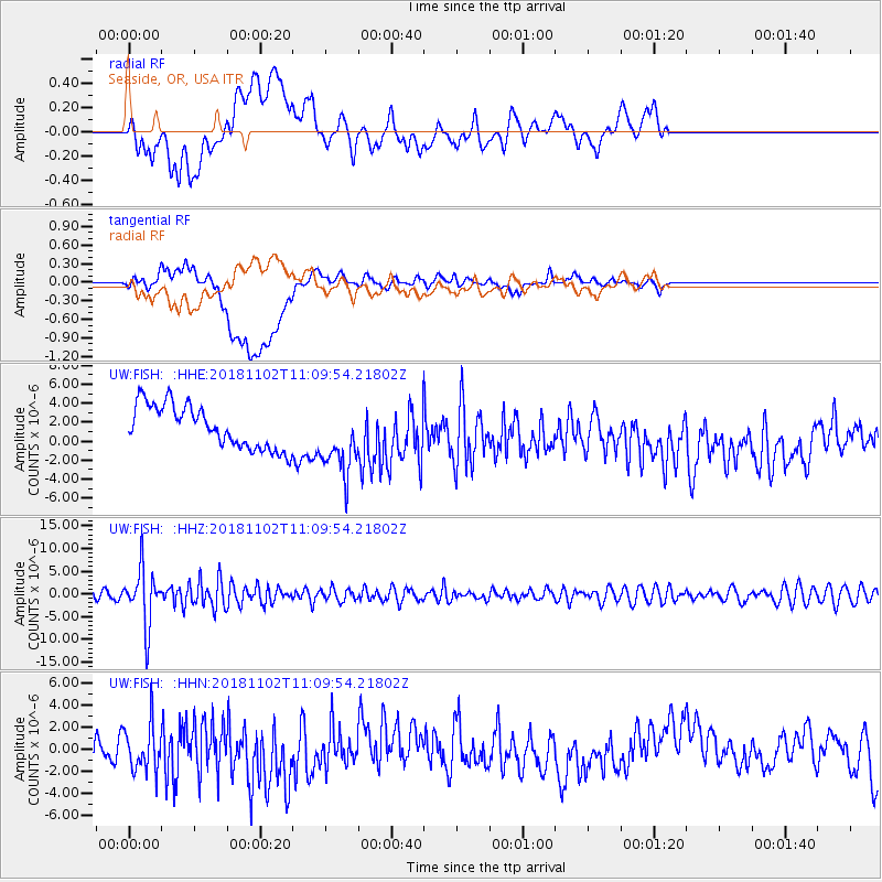
Signal To Noise
| Channel | StoN | STA | LTA |
| UW:FISH: :HHZ:20181102T11:09:54.21802Z | 7.6571193 | 6.3343987E-6 | 8.272561E-7 |
| UW:FISH: :HHN:20181102T11:09:54.21802Z | 1.3901566 | 2.1045844E-6 | 1.5139188E-6 |
| UW:FISH: :HHE:20181102T11:09:54.21802Z | 1.6418586 | 3.674129E-6 | 2.2377865E-6 |
| Arrivals |
| Ps | |
| PpPs | |
| PsPs/PpSs | |


