You are here: Home > Network List > TS - TERRAscope (Southern California Seismic Network) Stations List
> Station BAR Barrett Dam, California, USA > Earthquake Result Viewer
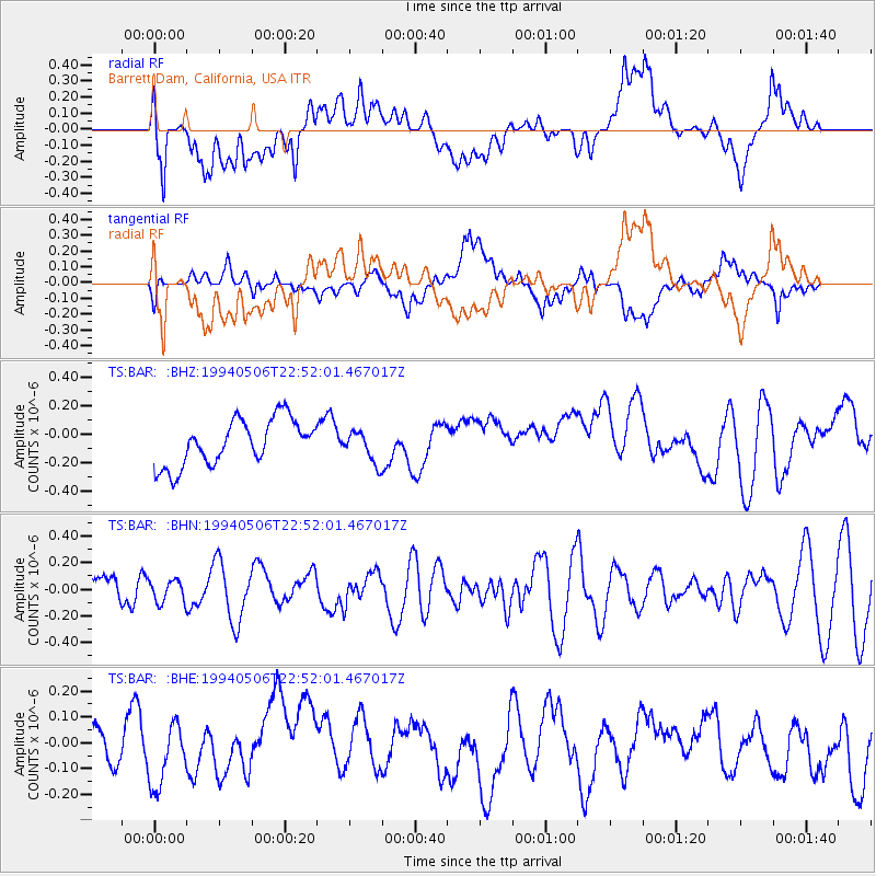
BAR Barrett Dam, California, USA - Earthquake Result Viewer
*The percent match for this event was below the threshold and hence no stack was calculated.
| Earthquake location: |
New Ireland Region, P.N.G. |
| Earthquake latitude/longitude: |
-4.7/153.1 |
| Earthquake time(UTC): |
1994/05/06 (126) 22:39:29 GMT |
| Earthquake Depth: |
79 km |
| Earthquake Magnitude: |
5.7 MB, 5.9 UNKNOWN |
| Earthquake Catalog/Contributor: |
WHDF/NEIC |
|
| Network: |
TS TERRAscope (Southern California Seismic Network) |
| Station: |
BAR Barrett Dam, California, USA |
| Lat/Lon: |
32.68 N/116.67 W |
| Elevation: |
548 m |
|
| Distance: |
92.7 deg |
| Az: |
57.596 deg |
| Baz: |
266.151 deg |
| Ray Param: |
$rayparam |
*The percent match for this event was below the threshold and hence was not used in the summary stack. |
|
| Radial Match: |
52.738884 % |
| Radial Bump: |
400 |
| Transverse Match: |
67.569084 % |
| Transverse Bump: |
400 |
| SOD ConfigId: |
4480 |
| Insert Time: |
2010-02-26 13:59:59.099 +0000 |
| GWidth: |
2.5 |
| Max Bumps: |
400 |
| Tol: |
0.001 |
|
Signal To Noise
| Channel | StoN | STA | LTA |
| TS:BAR: :BHN:19940506T22:52:01.467017Z | 0.7332394 | 8.650452E-8 | 1.17975816E-7 |
| TS:BAR: :BHE:19940506T22:52:01.467017Z | 1.2172087 | 1.1029336E-7 | 9.06117E-8 |
| TS:BAR: :BHZ:19940506T22:52:01.467017Z | 0.6941443 | 1.1143502E-7 | 1.605358E-7 |
| Arrivals |
| Ps | |
| PpPs | |
| PsPs/PpSs | |


