You are here: Home > Network List > CI - Caltech Regional Seismic Network Stations List
> Station MPM Manuel Prospect Mine, California, USA > Earthquake Result Viewer
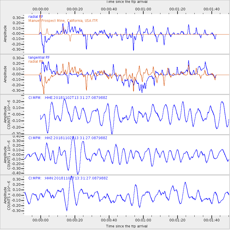
MPM Manuel Prospect Mine, California, USA - Earthquake Result Viewer
*The percent match for this event was below the threshold and hence no stack was calculated.
| Earthquake location: |
New Britain Region, P.N.G. |
| Earthquake latitude/longitude: |
-6.4/153.4 |
| Earthquake time(UTC): |
2018/11/02 (306) 13:18:45 GMT |
| Earthquake Depth: |
10 km |
| Earthquake Magnitude: |
5.4 Mww |
| Earthquake Catalog/Contributor: |
NEIC PDE/us |
|
| Network: |
CI Caltech Regional Seismic Network |
| Station: |
MPM Manuel Prospect Mine, California, USA |
| Lat/Lon: |
36.06 N/117.49 W |
| Elevation: |
185 m |
|
| Distance: |
93.0 deg |
| Az: |
54.221 deg |
| Baz: |
264.32 deg |
| Ray Param: |
$rayparam |
*The percent match for this event was below the threshold and hence was not used in the summary stack. |
|
| Radial Match: |
60.748466 % |
| Radial Bump: |
400 |
| Transverse Match: |
51.086533 % |
| Transverse Bump: |
400 |
| SOD ConfigId: |
13570011 |
| Insert Time: |
2019-05-01 17:45:29.407 +0000 |
| GWidth: |
2.5 |
| Max Bumps: |
400 |
| Tol: |
0.001 |
|
Signal To Noise
| Channel | StoN | STA | LTA |
| CI:MPM: :HHZ:20181102T13:31:27.087988Z | 0.79206675 | 1.2166558E-7 | 1.5360521E-7 |
| CI:MPM: :HHN:20181102T13:31:27.087988Z | 1.5185605 | 1.1250283E-7 | 7.4085186E-8 |
| CI:MPM: :HHE:20181102T13:31:27.087988Z | 0.5490267 | 6.226746E-8 | 1.1341426E-7 |
| Arrivals |
| Ps | |
| PpPs | |
| PsPs/PpSs | |


