You are here: Home > Network List > TA - USArray Transportable Network (new EarthScope stations) Stations List
> Station J20K Nowitna River, AK, USA > Earthquake Result Viewer
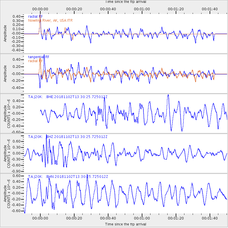
J20K Nowitna River, AK, USA - Earthquake Result Viewer
*The percent match for this event was below the threshold and hence no stack was calculated.
| Earthquake location: |
New Britain Region, P.N.G. |
| Earthquake latitude/longitude: |
-6.4/153.4 |
| Earthquake time(UTC): |
2018/11/02 (306) 13:18:45 GMT |
| Earthquake Depth: |
10 km |
| Earthquake Magnitude: |
5.4 Mww |
| Earthquake Catalog/Contributor: |
NEIC PDE/us |
|
| Network: |
TA USArray Transportable Network (new EarthScope stations) |
| Station: |
J20K Nowitna River, AK, USA |
| Lat/Lon: |
64.18 N/154.15 W |
| Elevation: |
314 m |
|
| Distance: |
80.4 deg |
| Az: |
20.608 deg |
| Baz: |
233.011 deg |
| Ray Param: |
$rayparam |
*The percent match for this event was below the threshold and hence was not used in the summary stack. |
|
| Radial Match: |
55.92506 % |
| Radial Bump: |
400 |
| Transverse Match: |
77.26498 % |
| Transverse Bump: |
400 |
| SOD ConfigId: |
13570011 |
| Insert Time: |
2019-05-01 17:48:06.403 +0000 |
| GWidth: |
2.5 |
| Max Bumps: |
400 |
| Tol: |
0.001 |
|
Signal To Noise
| Channel | StoN | STA | LTA |
| TA:J20K: :BHZ:20181102T13:30:25.725012Z | 2.1659184 | 3.4650483E-7 | 1.5998056E-7 |
| TA:J20K: :BHN:20181102T13:30:25.725012Z | 0.9113039 | 2.9417544E-7 | 3.2280718E-7 |
| TA:J20K: :BHE:20181102T13:30:25.725012Z | 1.1681542 | 1.4173652E-7 | 1.2133374E-7 |
| Arrivals |
| Ps | |
| PpPs | |
| PsPs/PpSs | |


