You are here: Home > Network List > TA - USArray Transportable Network (new EarthScope stations) Stations List
> Station 220A Playas Peak, Playas, NM, USA > Earthquake Result Viewer
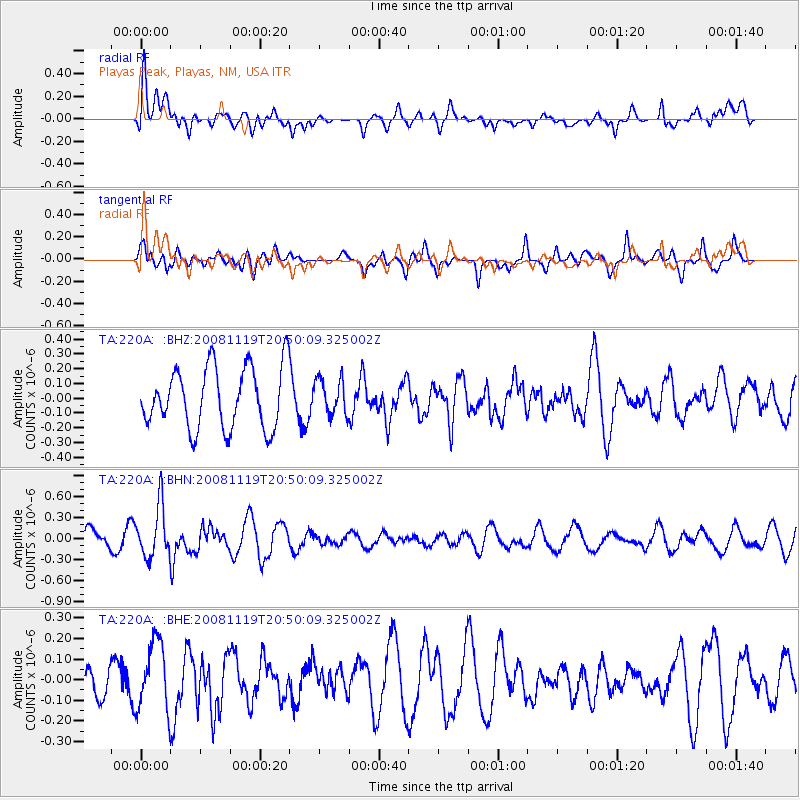
220A Playas Peak, Playas, NM, USA - Earthquake Result Viewer
*The percent match for this event was below the threshold and hence no stack was calculated.
| Earthquake location: |
South Of Fiji Islands |
| Earthquake latitude/longitude: |
-22.2/-179.7 |
| Earthquake time(UTC): |
2008/11/19 (324) 20:38:58 GMT |
| Earthquake Depth: |
596 km |
| Earthquake Magnitude: |
5.8 MW, 5.2 MB, 5.8 MW |
| Earthquake Catalog/Contributor: |
WHDF/NEIC |
|
| Network: |
TA USArray Transportable Network (new EarthScope stations) |
| Station: |
220A Playas Peak, Playas, NM, USA |
| Lat/Lon: |
31.90 N/108.53 W |
| Elevation: |
1395 m |
|
| Distance: |
86.7 deg |
| Az: |
53.746 deg |
| Baz: |
241.508 deg |
| Ray Param: |
$rayparam |
*The percent match for this event was below the threshold and hence was not used in the summary stack. |
|
| Radial Match: |
42.01188 % |
| Radial Bump: |
400 |
| Transverse Match: |
66.88287 % |
| Transverse Bump: |
400 |
| SOD ConfigId: |
2658 |
| Insert Time: |
2010-03-06 17:32:25.509 +0000 |
| GWidth: |
2.5 |
| Max Bumps: |
400 |
| Tol: |
0.001 |
|
Signal To Noise
| Channel | StoN | STA | LTA |
| TA:220A: :BHN:20081119T20:50:09.325002Z | 3.2553632 | 3.7106253E-7 | 1.1398499E-7 |
| TA:220A: :BHE:20081119T20:50:09.325002Z | 0.99309146 | 1.7049736E-7 | 1.7168344E-7 |
| TA:220A: :BHZ:20081119T20:50:09.325002Z | 0.59266835 | 1.2211221E-7 | 2.0603801E-7 |
| Arrivals |
| Ps | |
| PpPs | |
| PsPs/PpSs | |


