You are here: Home > Network List > TS - TERRAscope (Southern California Seismic Network) Stations List
> Station BAR Barrett Dam, California, USA > Earthquake Result Viewer
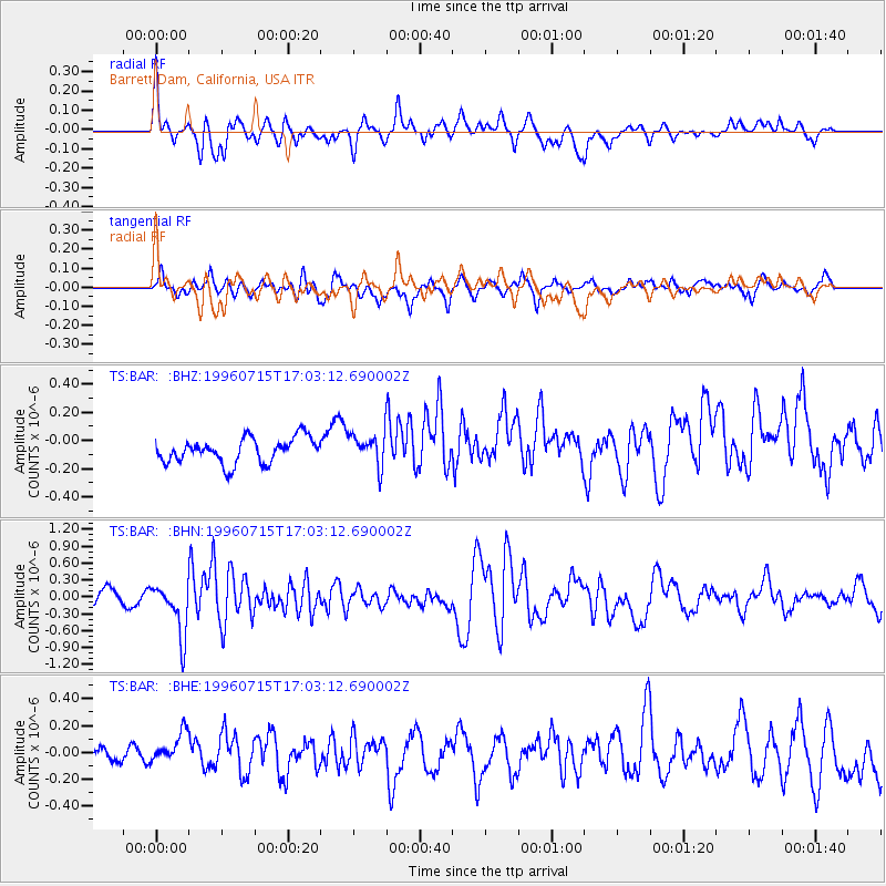
BAR Barrett Dam, California, USA - Earthquake Result Viewer
*The percent match for this event was below the threshold and hence no stack was calculated.
| Earthquake location: |
Mariana Islands |
| Earthquake latitude/longitude: |
18.7/145.6 |
| Earthquake time(UTC): |
1996/07/15 (197) 16:51:22 GMT |
| Earthquake Depth: |
177 km |
| Earthquake Magnitude: |
5.9 MB, 6.3 UNKNOWN, 6.3 MW |
| Earthquake Catalog/Contributor: |
WHDF/NEIC |
|
| Network: |
TS TERRAscope (Southern California Seismic Network) |
| Station: |
BAR Barrett Dam, California, USA |
| Lat/Lon: |
32.68 N/116.67 W |
| Elevation: |
548 m |
|
| Distance: |
86.3 deg |
| Az: |
56.874 deg |
| Baz: |
289.759 deg |
| Ray Param: |
$rayparam |
*The percent match for this event was below the threshold and hence was not used in the summary stack. |
|
| Radial Match: |
79.23425 % |
| Radial Bump: |
352 |
| Transverse Match: |
65.52479 % |
| Transverse Bump: |
400 |
| SOD ConfigId: |
4480 |
| Insert Time: |
2010-02-26 14:00:00.111 +0000 |
| GWidth: |
2.5 |
| Max Bumps: |
400 |
| Tol: |
0.001 |
|
Signal To Noise
| Channel | StoN | STA | LTA |
| TS:BAR: :BHN:19960715T17:03:12.690002Z | 2.5442865 | 4.7594463E-7 | 1.8706409E-7 |
| TS:BAR: :BHE:19960715T17:03:12.690002Z | 1.6742165 | 1.2589575E-7 | 7.519682E-8 |
| TS:BAR: :BHZ:19960715T17:03:12.690002Z | 1.2941048 | 1.14714126E-7 | 8.864362E-8 |
| Arrivals |
| Ps | |
| PpPs | |
| PsPs/PpSs | |


