You are here: Home > Network List > TA - USArray Transportable Network (new EarthScope stations) Stations List
> Station E20K Nigu River, AK, USA > Earthquake Result Viewer
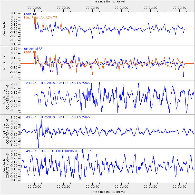
E20K Nigu River, AK, USA - Earthquake Result Viewer
*The percent match for this event was below the threshold and hence no stack was calculated.
| Earthquake location: |
Mindanao, Philippines |
| Earthquake latitude/longitude: |
7.8/123.9 |
| Earthquake time(UTC): |
2018/11/04 (308) 07:55:29 GMT |
| Earthquake Depth: |
598 km |
| Earthquake Magnitude: |
6.0 Mww |
| Earthquake Catalog/Contributor: |
NEIC PDE/us |
|
| Network: |
TA USArray Transportable Network (new EarthScope stations) |
| Station: |
E20K Nigu River, AK, USA |
| Lat/Lon: |
68.26 N/156.19 W |
| Elevation: |
866 m |
|
| Distance: |
79.1 deg |
| Az: |
21.94 deg |
| Baz: |
263.546 deg |
| Ray Param: |
$rayparam |
*The percent match for this event was below the threshold and hence was not used in the summary stack. |
|
| Radial Match: |
69.53148 % |
| Radial Bump: |
400 |
| Transverse Match: |
54.99978 % |
| Transverse Bump: |
400 |
| SOD ConfigId: |
13570011 |
| Insert Time: |
2019-05-01 17:57:21.921 +0000 |
| GWidth: |
2.5 |
| Max Bumps: |
400 |
| Tol: |
0.001 |
|
Signal To Noise
| Channel | StoN | STA | LTA |
| TA:E20K: :BHZ:20181104T08:06:01.97502Z | 3.7720678 | 5.5051646E-7 | 1.4594553E-7 |
| TA:E20K: :BHN:20181104T08:06:01.97502Z | 1.1541038 | 1.5200152E-7 | 1.3170525E-7 |
| TA:E20K: :BHE:20181104T08:06:01.97502Z | 1.1546602 | 1.1973745E-7 | 1.036993E-7 |
| Arrivals |
| Ps | |
| PpPs | |
| PsPs/PpSs | |


