You are here: Home > Network List > TA - USArray Transportable Network (new EarthScope stations) Stations List
> Station 220A Playas Peak, Playas, NM, USA > Earthquake Result Viewer
220A Playas Peak, Playas, NM, USA - Earthquake Result Viewer
*The percent match for this event was below the threshold and hence no stack was calculated.
| Earthquake location: |
Northern Chile |
| Earthquake latitude/longitude: |
-20.3/-69.2 |
| Earthquake time(UTC): |
2008/09/10 (254) 16:12:04 GMT |
| Earthquake Depth: |
38 km |
| Earthquake Magnitude: |
5.6 MB, 5.3 MS |
| Earthquake Catalog/Contributor: |
WHDF/NEIC |
|
| Network: |
TA USArray Transportable Network (new EarthScope stations) |
| Station: |
220A Playas Peak, Playas, NM, USA |
| Lat/Lon: |
31.90 N/108.53 W |
| Elevation: |
1395 m |
|
| Distance: |
64.1 deg |
| Az: |
323.209 deg |
| Baz: |
138.615 deg |
| Ray Param: |
$rayparam |
*The percent match for this event was below the threshold and hence was not used in the summary stack. |
|
| Radial Match: |
55.24697 % |
| Radial Bump: |
400 |
| Transverse Match: |
68.22523 % |
| Transverse Bump: |
400 |
| SOD ConfigId: |
2560 |
| Insert Time: |
2010-03-06 17:33:30.615 +0000 |
| GWidth: |
2.5 |
| Max Bumps: |
400 |
| Tol: |
0.001 |
|
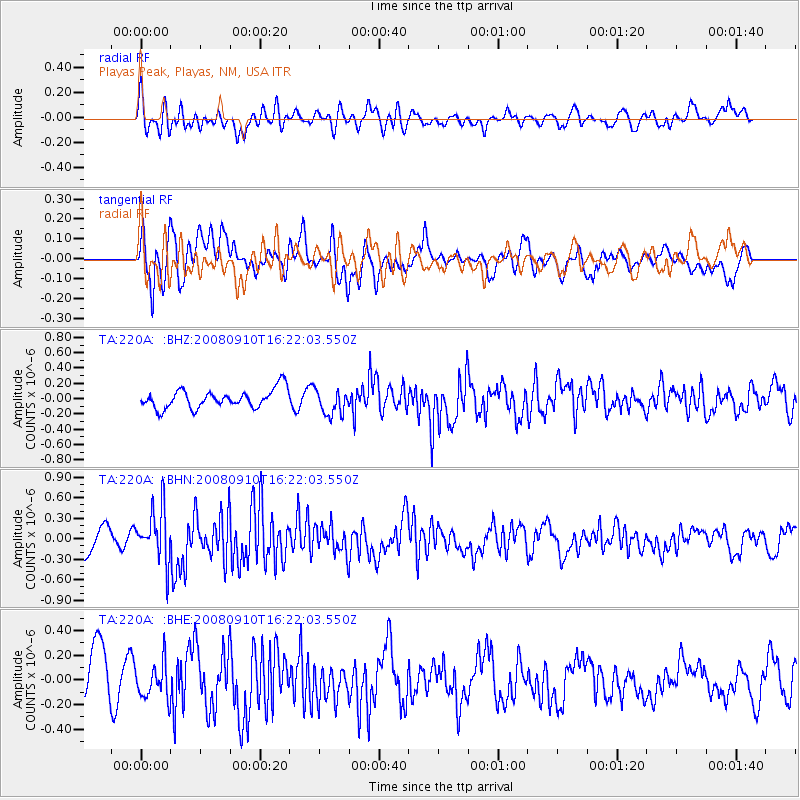
Signal To Noise
| Channel | StoN | STA | LTA |
| TA:220A: :BHN:20080910T16:22:03.550Z | 2.8166606 | 3.8823254E-7 | 1.3783433E-7 |
| TA:220A: :BHE:20080910T16:22:03.550Z | 0.96001875 | 1.4125388E-7 | 1.4713657E-7 |
| TA:220A: :BHZ:20080910T16:22:03.550Z | 1.3788956 | 1.6674662E-7 | 1.2092767E-7 |
| Arrivals |
| Ps | |
| PpPs | |
| PsPs/PpSs | |


