You are here: Home > Network List > US - United States National Seismic Network Stations List
> Station MNTX Cornudas Mountains, Texas, USA > Earthquake Result Viewer
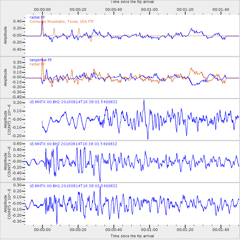
MNTX Cornudas Mountains, Texas, USA - Earthquake Result Viewer
*The percent match for this event was below the threshold and hence no stack was calculated.
| Earthquake location: |
Rat Islands, Aleutian Islands |
| Earthquake latitude/longitude: |
51.5/179.6 |
| Earthquake time(UTC): |
2016/08/14 (227) 16:28:55 GMT |
| Earthquake Depth: |
65 km |
| Earthquake Magnitude: |
5.6 MWB, 5.5 MI, 5.6 ML |
| Earthquake Catalog/Contributor: |
NEIC PDE/NEIC COMCAT |
|
| Network: |
US United States National Seismic Network |
| Station: |
MNTX Cornudas Mountains, Texas, USA |
| Lat/Lon: |
31.70 N/105.38 W |
| Elevation: |
404 m |
|
| Distance: |
56.9 deg |
| Az: |
79.34 deg |
| Baz: |
313.943 deg |
| Ray Param: |
$rayparam |
*The percent match for this event was below the threshold and hence was not used in the summary stack. |
|
| Radial Match: |
42.309628 % |
| Radial Bump: |
400 |
| Transverse Match: |
47.52605 % |
| Transverse Bump: |
400 |
| SOD ConfigId: |
1634031 |
| Insert Time: |
2016-08-28 16:34:05.660 +0000 |
| GWidth: |
2.5 |
| Max Bumps: |
400 |
| Tol: |
0.001 |
|
Signal To Noise
| Channel | StoN | STA | LTA |
| US:MNTX:00:BHZ:20160814T16:38:03.549983Z | 3.0592155 | 1.4298247E-7 | 4.673828E-8 |
| US:MNTX:00:BH1:20160814T16:38:03.549983Z | 0.9380913 | 9.328608E-8 | 9.944243E-8 |
| US:MNTX:00:BH2:20160814T16:38:03.549983Z | 0.7069961 | 4.2936787E-8 | 6.0731296E-8 |
| Arrivals |
| Ps | |
| PpPs | |
| PsPs/PpSs | |


