You are here: Home > Network List > TA - USArray Transportable Network (new EarthScope stations) Stations List
> Station P17K Kvichak River, AK, USA > Earthquake Result Viewer
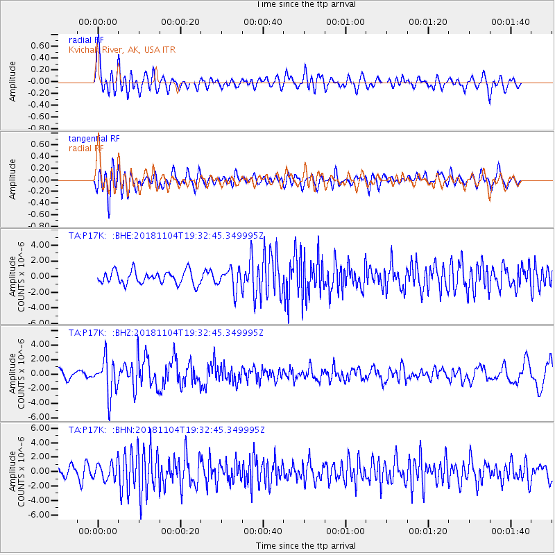
P17K Kvichak River, AK, USA - Earthquake Result Viewer
*The percent match for this event was below the threshold and hence no stack was calculated.
| Earthquake location: |
Hokkaido, Japan Region |
| Earthquake latitude/longitude: |
44.6/145.6 |
| Earthquake time(UTC): |
2018/11/04 (308) 19:26:03 GMT |
| Earthquake Depth: |
8.0 km |
| Earthquake Magnitude: |
5.9 Mww |
| Earthquake Catalog/Contributor: |
NEIC PDE/us |
|
| Network: |
TA USArray Transportable Network (new EarthScope stations) |
| Station: |
P17K Kvichak River, AK, USA |
| Lat/Lon: |
59.20 N/156.44 W |
| Elevation: |
91 m |
|
| Distance: |
37.4 deg |
| Az: |
45.955 deg |
| Baz: |
273.289 deg |
| Ray Param: |
$rayparam |
*The percent match for this event was below the threshold and hence was not used in the summary stack. |
|
| Radial Match: |
78.28388 % |
| Radial Bump: |
400 |
| Transverse Match: |
61.317802 % |
| Transverse Bump: |
400 |
| SOD ConfigId: |
13570011 |
| Insert Time: |
2019-05-01 18:13:18.815 +0000 |
| GWidth: |
2.5 |
| Max Bumps: |
400 |
| Tol: |
0.001 |
|
Signal To Noise
| Channel | StoN | STA | LTA |
| TA:P17K: :BHZ:20181104T19:32:45.349995Z | 6.096162 | 2.5514155E-6 | 4.1852817E-7 |
| TA:P17K: :BHN:20181104T19:32:45.349995Z | 1.4188807 | 1.1704038E-6 | 8.2487827E-7 |
| TA:P17K: :BHE:20181104T19:32:45.349995Z | 1.6725851 | 1.3681528E-6 | 8.179869E-7 |
| Arrivals |
| Ps | |
| PpPs | |
| PsPs/PpSs | |


