You are here: Home > Network List > AV - Alaska Volcano Observatory Stations List
> Station SPCR Ckakachatna River, Mount Spurr, Alaska > Earthquake Result Viewer
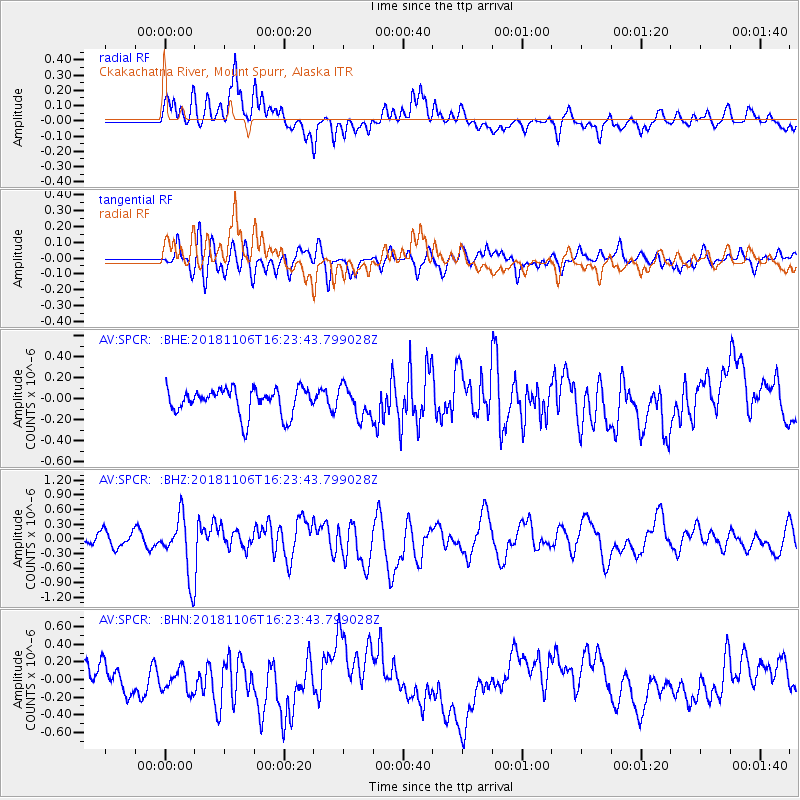
SPCR Ckakachatna River, Mount Spurr, Alaska - Earthquake Result Viewer
*The percent match for this event was below the threshold and hence no stack was calculated.
| Earthquake location: |
Tonga Islands Region |
| Earthquake latitude/longitude: |
-22.2/-174.5 |
| Earthquake time(UTC): |
2018/11/06 (310) 16:11:39 GMT |
| Earthquake Depth: |
10 km |
| Earthquake Magnitude: |
5.5 Mww |
| Earthquake Catalog/Contributor: |
NEIC PDE/us |
|
| Network: |
AV Alaska Volcano Observatory |
| Station: |
SPCR Ckakachatna River, Mount Spurr, Alaska |
| Lat/Lon: |
61.20 N/152.21 W |
| Elevation: |
984 m |
|
| Distance: |
85.0 deg |
| Az: |
10.638 deg |
| Baz: |
200.692 deg |
| Ray Param: |
$rayparam |
*The percent match for this event was below the threshold and hence was not used in the summary stack. |
|
| Radial Match: |
67.19836 % |
| Radial Bump: |
400 |
| Transverse Match: |
54.07533 % |
| Transverse Bump: |
400 |
| SOD ConfigId: |
13570011 |
| Insert Time: |
2019-05-01 18:18:13.072 +0000 |
| GWidth: |
2.5 |
| Max Bumps: |
400 |
| Tol: |
0.001 |
|
Signal To Noise
| Channel | StoN | STA | LTA |
| AV:SPCR: :BHZ:20181106T16:23:43.799028Z | 4.505481 | 6.177079E-7 | 1.3710144E-7 |
| AV:SPCR: :BHN:20181106T16:23:43.799028Z | 0.7043147 | 1.273497E-7 | 1.8081363E-7 |
| AV:SPCR: :BHE:20181106T16:23:43.799028Z | 1.1717373 | 1.4762308E-7 | 1.259865E-7 |
| Arrivals |
| Ps | |
| PpPs | |
| PsPs/PpSs | |


