You are here: Home > Network List > TA - USArray Transportable Network (new EarthScope stations) Stations List
> Station L15K Ungalak Mountain, AK, USA > Earthquake Result Viewer
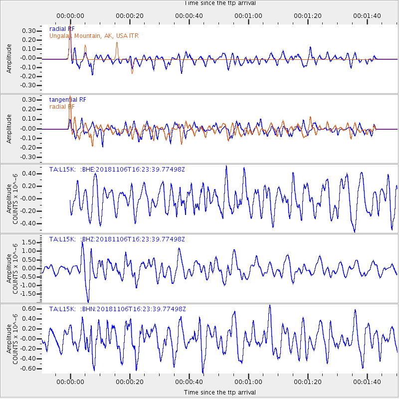
L15K Ungalak Mountain, AK, USA - Earthquake Result Viewer
*The percent match for this event was below the threshold and hence no stack was calculated.
| Earthquake location: |
Tonga Islands Region |
| Earthquake latitude/longitude: |
-22.2/-174.5 |
| Earthquake time(UTC): |
2018/11/06 (310) 16:11:39 GMT |
| Earthquake Depth: |
10 km |
| Earthquake Magnitude: |
5.5 Mww |
| Earthquake Catalog/Contributor: |
NEIC PDE/us |
|
| Network: |
TA USArray Transportable Network (new EarthScope stations) |
| Station: |
L15K Ungalak Mountain, AK, USA |
| Lat/Lon: |
61.68 N/161.49 W |
| Elevation: |
219 m |
|
| Distance: |
84.2 deg |
| Az: |
6.21 deg |
| Baz: |
192.136 deg |
| Ray Param: |
$rayparam |
*The percent match for this event was below the threshold and hence was not used in the summary stack. |
|
| Radial Match: |
59.604256 % |
| Radial Bump: |
396 |
| Transverse Match: |
63.124027 % |
| Transverse Bump: |
395 |
| SOD ConfigId: |
13570011 |
| Insert Time: |
2019-05-01 18:23:47.043 +0000 |
| GWidth: |
2.5 |
| Max Bumps: |
400 |
| Tol: |
0.001 |
|
Signal To Noise
| Channel | StoN | STA | LTA |
| TA:L15K: :BHZ:20181106T16:23:39.77498Z | 2.5759394 | 5.358954E-7 | 2.0803884E-7 |
| TA:L15K: :BHN:20181106T16:23:39.77498Z | 1.2169322 | 1.9850005E-7 | 1.6311512E-7 |
| TA:L15K: :BHE:20181106T16:23:39.77498Z | 0.92531544 | 1.7645914E-7 | 1.907016E-7 |
| Arrivals |
| Ps | |
| PpPs | |
| PsPs/PpSs | |


