You are here: Home > Network List > US - United States National Seismic Network Stations List
> Station HAWA Hanford, Washington, USA > Earthquake Result Viewer
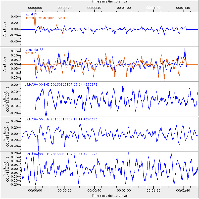
HAWA Hanford, Washington, USA - Earthquake Result Viewer
*The percent match for this event was below the threshold and hence no stack was calculated.
| Earthquake location: |
Near East Coast Of Honshu, Japan |
| Earthquake latitude/longitude: |
37.4/141.7 |
| Earthquake time(UTC): |
2016/08/15 (228) 07:04:40 GMT |
| Earthquake Depth: |
28 km |
| Earthquake Magnitude: |
5.6 MB |
| Earthquake Catalog/Contributor: |
NEIC PDE/NEIC COMCAT |
|
| Network: |
US United States National Seismic Network |
| Station: |
HAWA Hanford, Washington, USA |
| Lat/Lon: |
46.39 N/119.53 W |
| Elevation: |
364 m |
|
| Distance: |
69.3 deg |
| Az: |
46.992 deg |
| Baz: |
302.738 deg |
| Ray Param: |
$rayparam |
*The percent match for this event was below the threshold and hence was not used in the summary stack. |
|
| Radial Match: |
39.20342 % |
| Radial Bump: |
400 |
| Transverse Match: |
49.515003 % |
| Transverse Bump: |
400 |
| SOD ConfigId: |
1634031 |
| Insert Time: |
2016-08-29 07:09:49.179 +0000 |
| GWidth: |
2.5 |
| Max Bumps: |
400 |
| Tol: |
0.001 |
|
Signal To Noise
| Channel | StoN | STA | LTA |
| US:HAWA:00:BHZ:20160815T07:15:14.425027Z | 1.4840562 | 1.9753197E-7 | 1.3310276E-7 |
| US:HAWA:00:BH1:20160815T07:15:14.425027Z | 1.0397934 | 1.1103951E-7 | 1.06789976E-7 |
| US:HAWA:00:BH2:20160815T07:15:14.425027Z | 0.85889965 | 7.218285E-8 | 8.404107E-8 |
| Arrivals |
| Ps | |
| PpPs | |
| PsPs/PpSs | |


