G04A Mulino, OR, USA - Earthquake Result Viewer
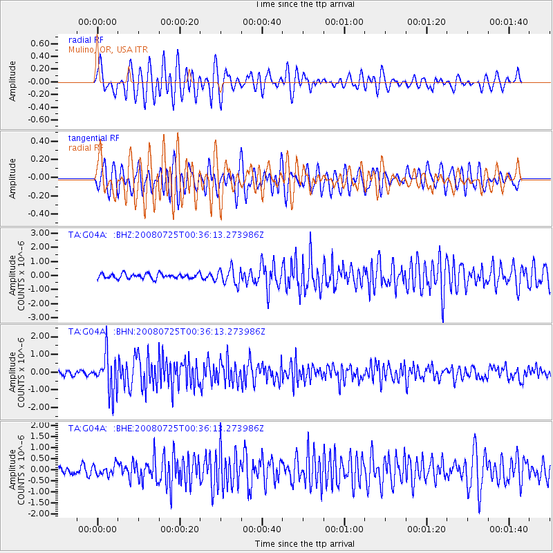
Earthquake location: Rat Islands, Aleutian Islands
Earthquake latitude/longitude: 51.3/179.0
Earthquake time(UTC): 2008/07/25 (207) 00:29:22 GMT
Earthquake Depth: 21 km
Earthquake Magnitude: 5.7 MB, 5.5 MS, 5.9 MW, 5.9 MW
Earthquake Catalog/Contributor: WHDF/NEIC
Network: TA USArray Transportable Network (new EarthScope stations)
Station: G04A Mulino, OR, USA
Lat/Lon: 45.21 N/122.48 W
Elevation: 273 m
Distance: 38.5 deg
Az: 75.396 deg
Baz: 300.712 deg
Ray Param: 0.0754706
Estimated Moho Depth: 44.5 km
Estimated Crust Vp/Vs: 2.10
Assumed Crust Vp: 6.566 km/s
Estimated Crust Vs: 3.13 km/s
Estimated Crust Poisson's Ratio: 0.35
Radial Match: 80.39832 %
Radial Bump: 400
Transverse Match: 66.50038 %
Transverse Bump: 400
SOD ConfigId: 2504
Insert Time: 2010-03-06 17:40:16.352 +0000
GWidth: 2.5
Max Bumps: 400
Tol: 0.001

Signal To Noise

ChannelStoNSTALTA
TA:G04A: :BHN:20080725T00:36:13.273986Z9.6619941.0809393E-61.1187539E-7
TA:G04A: :BHE:20080725T00:36:13.273986Z1.46850342.4064695E-71.6387224E-7
TA:G04A: :BHZ:20080725T00:36:13.273986Z3.2955645.7314986E-71.7391557E-7
Arrivals
Ps7.9 SECOND
PpPs20 SECOND
PsPs/PpSs28 SECOND