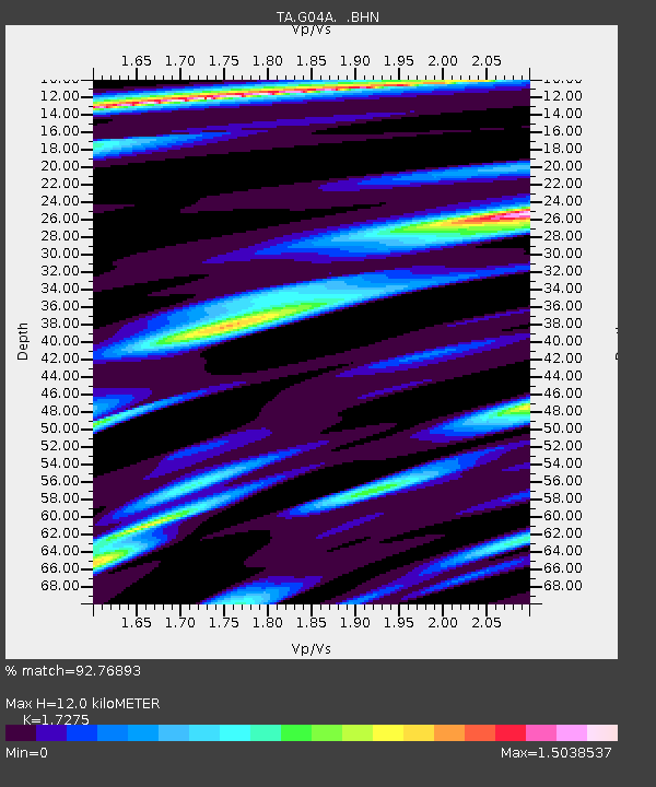
G04A Mulino, OR, USA - Earthquake Result Viewer
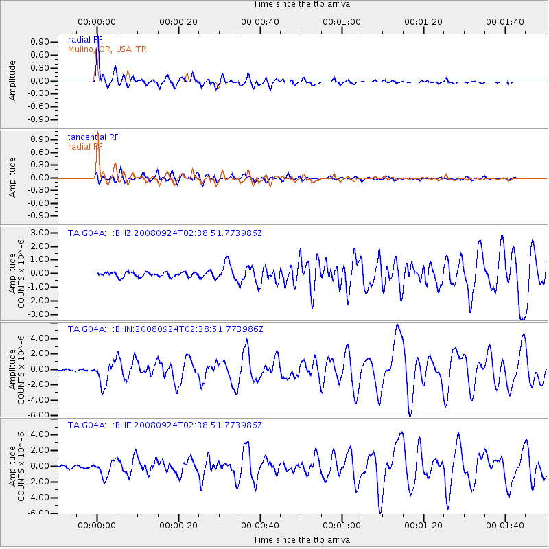
Earthquake location: Off Coast Of Jalisco, Mexico
Earthquake latitude/longitude: 17.6/-105.5
Earthquake time(UTC): 2008/09/24 (268) 02:33:05 GMT
Earthquake Depth: 10 km
Earthquake Magnitude: 5.7 MB, 6.2 MS, 6.4 MW, 6.4 MW
Earthquake Catalog/Contributor: WHDF/NEIC
Network: TA USArray Transportable Network (new EarthScope stations)
Station: G04A Mulino, OR, USA
Lat/Lon: 45.21 N/122.48 W
Elevation: 273 m
Distance: 31.0 deg
Az: 336.345 deg
Baz: 147.228 deg
Ray Param: 0.07919375
Estimated Moho Depth: 12.0 km
Estimated Crust Vp/Vs: 1.73
Assumed Crust Vp: 6.566 km/s
Estimated Crust Vs: 3.801 km/s
Estimated Crust Poisson's Ratio: 0.25
Radial Match: 92.76893 %
Radial Bump: 400
Transverse Match: 74.93538 %
Transverse Bump: 400
SOD ConfigId: 2560
Insert Time: 2010-03-06 17:40:20.802 +0000
GWidth: 2.5
Max Bumps: 400
Tol: 0.001

Signal To Noise

ChannelStoNSTALTA
TA:G04A: :BHN:20080924T02:38:51.773986Z17.1166571.4884756E-68.696065E-8
TA:G04A: :BHE:20080924T02:38:51.773986Z6.752619.971158E-71.4766376E-7
TA:G04A: :BHZ:20080924T02:38:51.773986Z4.2899286.746159E-71.5725576E-7
Arrivals
Ps1.4 SECOND
PpPs4.6 SECOND
PsPs/PpSs6.0 SECOND