You are here: Home > Network List > TS - TERRAscope (Southern California Seismic Network) Stations List
> Station BAR Barrett Dam, California, USA > Earthquake Result Viewer
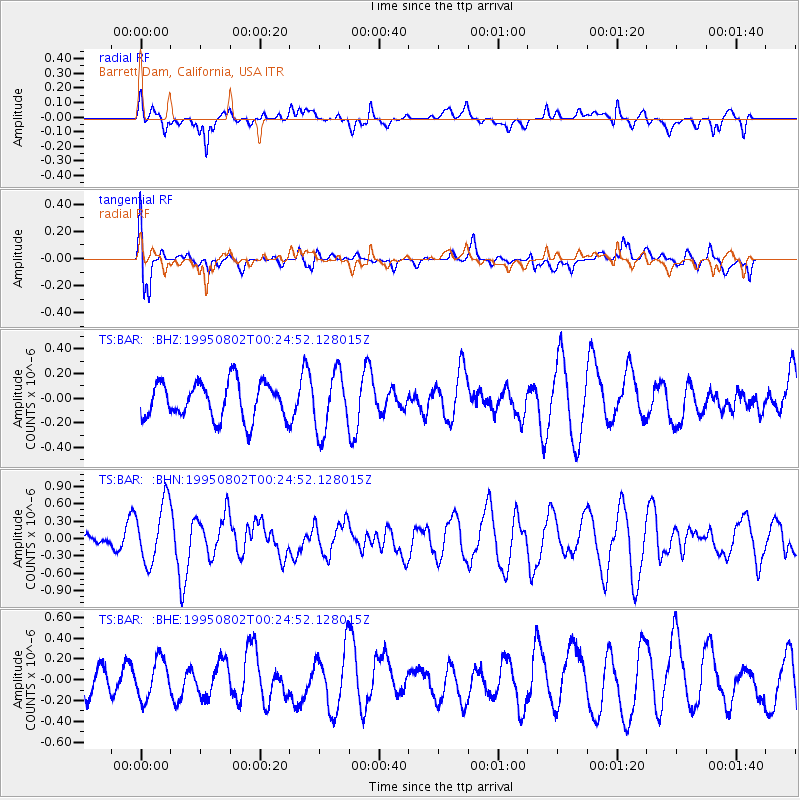
BAR Barrett Dam, California, USA - Earthquake Result Viewer
*The percent match for this event was below the threshold and hence no stack was calculated.
| Earthquake location: |
Near Coast Of Northern Chile |
| Earthquake latitude/longitude: |
-23.2/-70.6 |
| Earthquake time(UTC): |
1995/08/02 (214) 00:14:09 GMT |
| Earthquake Depth: |
33 km |
| Earthquake Magnitude: |
5.4 MB, 5.5 MS, 5.3 UNKNOWN |
| Earthquake Catalog/Contributor: |
WHDF/NEIC |
|
| Network: |
TS TERRAscope (Southern California Seismic Network) |
| Station: |
BAR Barrett Dam, California, USA |
| Lat/Lon: |
32.68 N/116.67 W |
| Elevation: |
548 m |
|
| Distance: |
70.8 deg |
| Az: |
319.966 deg |
| Baz: |
135.41 deg |
| Ray Param: |
$rayparam |
*The percent match for this event was below the threshold and hence was not used in the summary stack. |
|
| Radial Match: |
62.37984 % |
| Radial Bump: |
400 |
| Transverse Match: |
60.68563 % |
| Transverse Bump: |
400 |
| SOD ConfigId: |
4480 |
| Insert Time: |
2010-02-26 14:00:15.522 +0000 |
| GWidth: |
2.5 |
| Max Bumps: |
400 |
| Tol: |
0.001 |
|
Signal To Noise
| Channel | StoN | STA | LTA |
| TS:BAR: :BHN:19950802T00:24:52.128015Z | 1.78094 | 5.520937E-7 | 3.1000127E-7 |
| TS:BAR: :BHE:19950802T00:24:52.128015Z | 1.2442932 | 1.8652078E-7 | 1.4990098E-7 |
| TS:BAR: :BHZ:19950802T00:24:52.128015Z | 1.6103255 | 2.3824867E-7 | 1.4795063E-7 |
| Arrivals |
| Ps | |
| PpPs | |
| PsPs/PpSs | |


