G04A Mulino, OR, USA - Earthquake Result Viewer
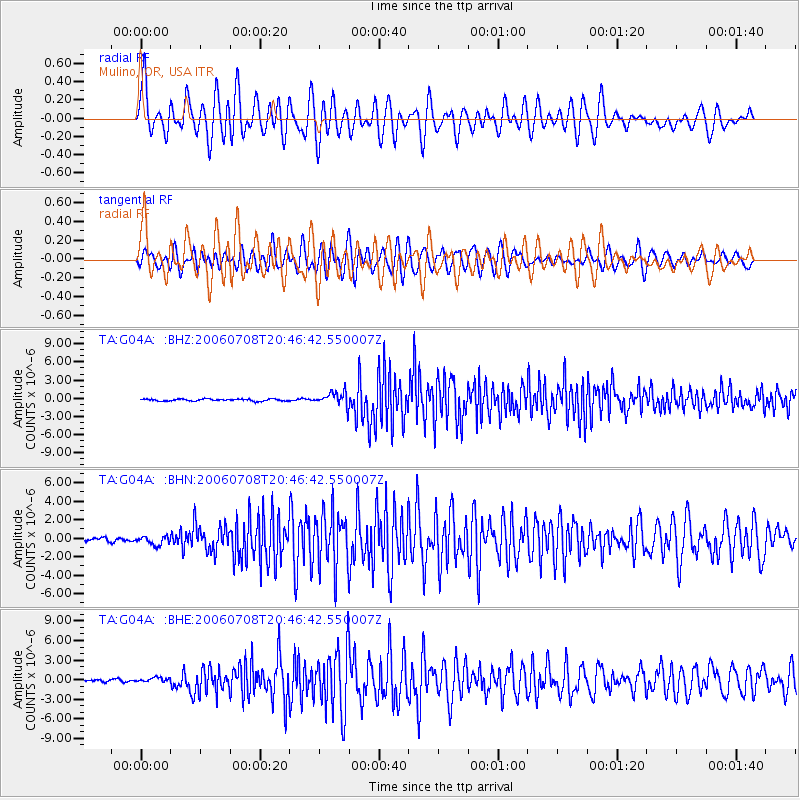
Earthquake location: Andreanof Islands, Aleutian Is.
Earthquake latitude/longitude: 51.2/-179.3
Earthquake time(UTC): 2006/07/08 (189) 20:40:00 GMT
Earthquake Depth: 22 km
Earthquake Magnitude: 6.2 MB, 6.4 MS, 6.6 MW, 6.6 MW
Earthquake Catalog/Contributor: WHDF/NEIC
Network: TA USArray Transportable Network (new EarthScope stations)
Station: G04A Mulino, OR, USA
Lat/Lon: 45.21 N/122.48 W
Elevation: 273 m
Distance: 37.5 deg
Az: 76.307 deg
Baz: 300.184 deg
Ray Param: 0.07605971
Estimated Moho Depth: 52.5 km
Estimated Crust Vp/Vs: 1.93
Assumed Crust Vp: 6.566 km/s
Estimated Crust Vs: 3.402 km/s
Estimated Crust Poisson's Ratio: 0.32
Radial Match: 87.003 %
Radial Bump: 400
Transverse Match: 65.67955 %
Transverse Bump: 400
SOD ConfigId: 2665
Insert Time: 2010-03-06 17:41:32.433 +0000
GWidth: 2.5
Max Bumps: 400
Tol: 0.001

Signal To Noise

ChannelStoNSTALTA
TA:G04A: :BHN:20060708T20:46:42.550007Z2.16960244.539154E-72.0921593E-7
TA:G04A: :BHE:20060708T20:46:42.550007Z1.74709843.5875175E-72.0534146E-7
TA:G04A: :BHZ:20060708T20:46:42.550007Z7.2492541.1622583E-61.6032799E-7
Arrivals
Ps8.0 SECOND
PpPs22 SECOND
PsPs/PpSs30 SECOND