
G04A Mulino, OR, USA - Earthquake Result Viewer
| ||||||||||||||||||
| ||||||||||||||||||
| ||||||||||||||||||
|
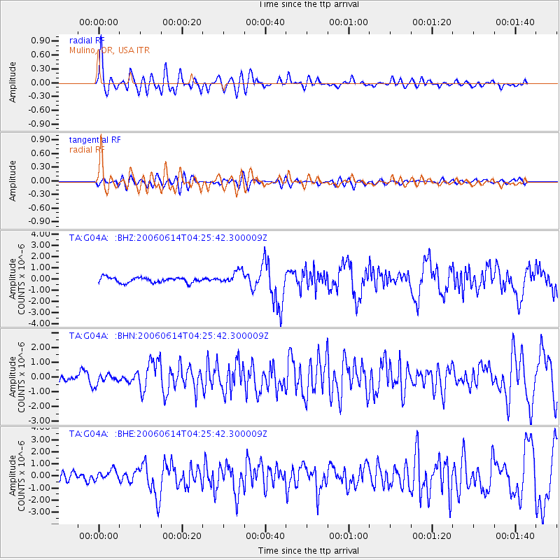
Signal To Noise
| Channel | StoN | STA | LTA |
| TA:G04A: :BHN:20060614T04:25:42.300009Z | 0.754547 | 2.946131E-7 | 3.904503E-7 |
| TA:G04A: :BHE:20060614T04:25:42.300009Z | 0.9173031 | 4.4235438E-7 | 4.822336E-7 |
| TA:G04A: :BHZ:20060614T04:25:42.300009Z | 2.6029773 | 6.104778E-7 | 2.345306E-7 |
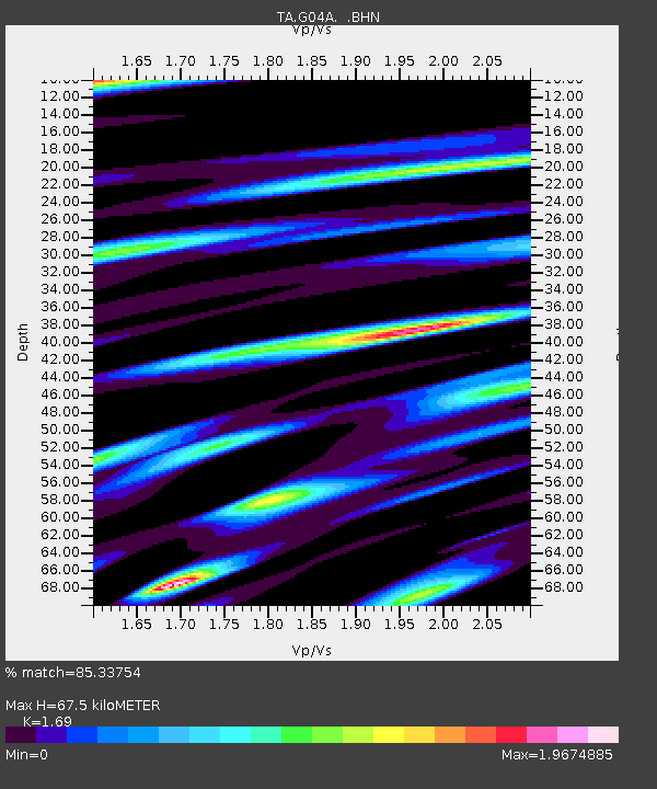
| Arrivals | |
| Ps | 7.7 SECOND |
| PpPs | 26 SECOND |
| PsPs/PpSs | 33 SECOND |

