
G04A Mulino, OR, USA - Earthquake Result Viewer
| ||||||||||||||||||
| ||||||||||||||||||
| ||||||||||||||||||
|
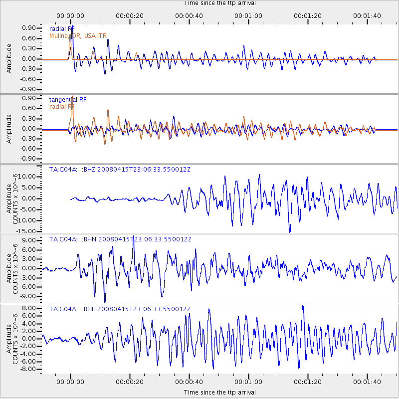
Signal To Noise
| Channel | StoN | STA | LTA |
| TA:G04A: :BHN:20080415T23:06:33.550012Z | 4.0536003 | 1.87916E-6 | 4.6357803E-7 |
| TA:G04A: :BHE:20080415T23:06:33.550012Z | 1.2536974 | 5.766934E-7 | 4.5999408E-7 |
| TA:G04A: :BHZ:20080415T23:06:33.550012Z | 2.4991484 | 1.1896967E-6 | 4.7604084E-7 |
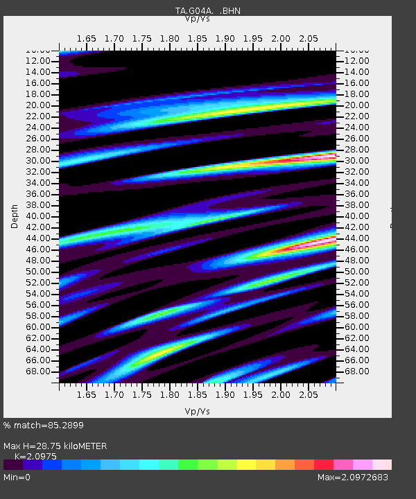
| Arrivals | |
| Ps | 5.1 SECOND |
| PpPs | 13 SECOND |
| PsPs/PpSs | 18 SECOND |

