You are here: Home > Network List > TA - USArray Transportable Network (new EarthScope stations) Stations List
> Station B22K Teshekpuk Lake, AK, USA > Earthquake Result Viewer
B22K Teshekpuk Lake, AK, USA - Earthquake Result Viewer

| Earthquake location: |
Jan Mayen Island Region |
| Earthquake latitude/longitude: |
71.6/-11.2 |
| Earthquake time(UTC): |
2018/11/09 (313) 01:49:40 GMT |
| Earthquake Depth: |
10 km |
| Earthquake Magnitude: |
6.8 Mww |
| Earthquake Catalog/Contributor: |
NEIC PDE/us |
|
| Network: |
TA USArray Transportable Network (new EarthScope stations) |
| Station: |
B22K Teshekpuk Lake, AK, USA |
| Lat/Lon: |
70.34 N/153.42 W |
| Elevation: |
50 m |
|
| Distance: |
36.1 deg |
| Az: |
339.396 deg |
| Baz: |
19.257 deg |
| Ray Param: |
0.076843895 |
| Estimated Moho Depth: |
29.25 km |
| Estimated Crust Vp/Vs: |
2.00 |
| Assumed Crust Vp: |
5.738 km/s |
| Estimated Crust Vs: |
2.873 km/s |
| Estimated Crust Poisson's Ratio: |
0.33 |
|
| Radial Match: |
89.89127 % |
| Radial Bump: |
400 |
| Transverse Match: |
76.316444 % |
| Transverse Bump: |
400 |
| SOD ConfigId: |
13570011 |
| Insert Time: |
2019-05-01 18:37:57.820 +0000 |
| GWidth: |
2.5 |
| Max Bumps: |
400 |
| Tol: |
0.001 |
|
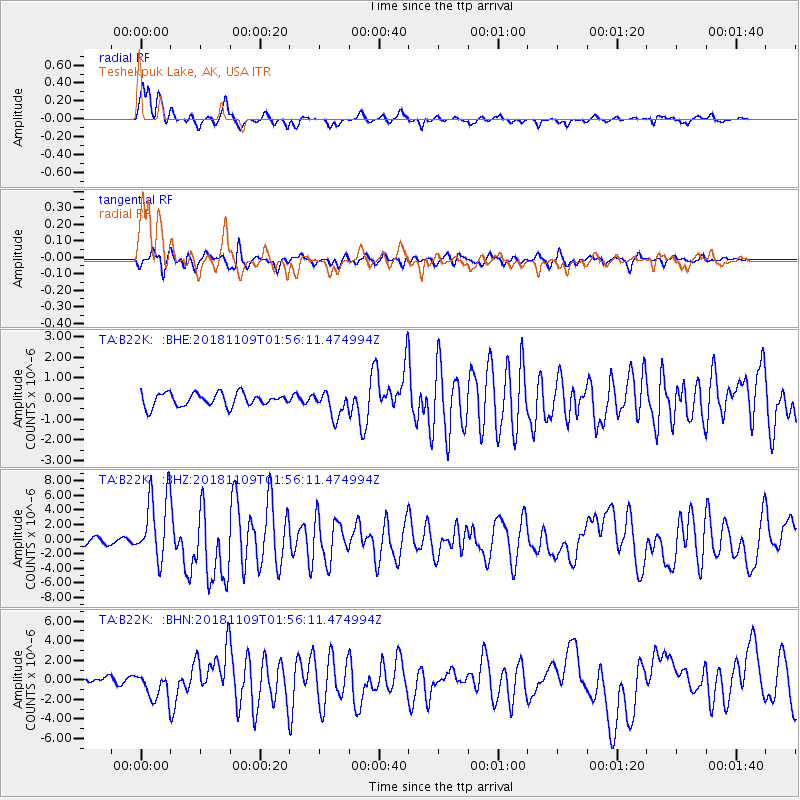
Signal To Noise
| Channel | StoN | STA | LTA |
| TA:B22K: :BHZ:20181109T01:56:11.474994Z | 12.501248 | 4.5655474E-6 | 3.652073E-7 |
| TA:B22K: :BHN:20181109T01:56:11.474994Z | 6.015179 | 1.3969608E-6 | 2.3223927E-7 |
| TA:B22K: :BHE:20181109T01:56:11.474994Z | 1.9582276 | 6.1961134E-7 | 3.1641434E-7 |
| Arrivals |
| Ps | 5.4 SECOND |
| PpPs | 15 SECOND |
| PsPs/PpSs | 20 SECOND |


