
G04A Mulino, OR, USA - Earthquake Result Viewer
| ||||||||||||||||||
| ||||||||||||||||||
| ||||||||||||||||||
|
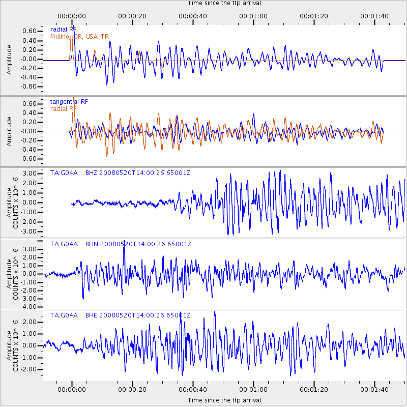
Signal To Noise
| Channel | StoN | STA | LTA |
| TA:G04A: :BHN:20080520T14:00:26.65001Z | 6.2893667 | 9.1331515E-7 | 1.4521576E-7 |
| TA:G04A: :BHE:20080520T14:00:26.65001Z | 1.3259302 | 2.9953512E-7 | 2.2590564E-7 |
| TA:G04A: :BHZ:20080520T14:00:26.65001Z | 1.805365 | 2.6701883E-7 | 1.4790297E-7 |
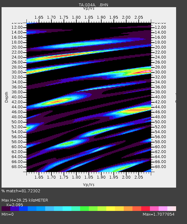
| Arrivals | |
| Ps | 5.2 SECOND |
| PpPs | 13 SECOND |
| PsPs/PpSs | 18 SECOND |

