You are here: Home > Network List > TA - USArray Transportable Network (new EarthScope stations) Stations List
> Station G04A Mulino, OR, USA > Earthquake Result Viewer
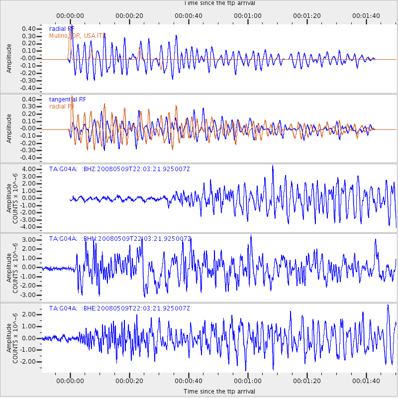
G04A Mulino, OR, USA - Earthquake Result Viewer
*The percent match for this event was below the threshold and hence no stack was calculated.
| Earthquake location: |
South Of Mariana Islands |
| Earthquake latitude/longitude: |
12.5/143.2 |
| Earthquake time(UTC): |
2008/05/09 (130) 21:51:29 GMT |
| Earthquake Depth: |
76 km |
| Earthquake Magnitude: |
6.1 MB, 6.7 MW, 6.7 MW |
| Earthquake Catalog/Contributor: |
WHDF/NEIC |
|
| Network: |
TA USArray Transportable Network (new EarthScope stations) |
| Station: |
G04A Mulino, OR, USA |
| Lat/Lon: |
45.21 N/122.48 W |
| Elevation: |
273 m |
|
| Distance: |
84.3 deg |
| Az: |
45.11 deg |
| Baz: |
281.861 deg |
| Ray Param: |
$rayparam |
*The percent match for this event was below the threshold and hence was not used in the summary stack. |
|
| Radial Match: |
52.903545 % |
| Radial Bump: |
400 |
| Transverse Match: |
82.83949 % |
| Transverse Bump: |
400 |
| SOD ConfigId: |
2504 |
| Insert Time: |
2010-03-06 17:42:02.790 +0000 |
| GWidth: |
2.5 |
| Max Bumps: |
400 |
| Tol: |
0.001 |
|
Signal To Noise
| Channel | StoN | STA | LTA |
| TA:G04A: :BHN:20080509T22:03:21.925007Z | 9.413102 | 1.0673804E-6 | 1.1339304E-7 |
| TA:G04A: :BHE:20080509T22:03:21.925007Z | 1.1622527 | 1.95461E-7 | 1.6817427E-7 |
| TA:G04A: :BHZ:20080509T22:03:21.925007Z | 1.8100792 | 3.728236E-7 | 2.0597088E-7 |
| Arrivals |
| Ps | |
| PpPs | |
| PsPs/PpSs | |


